

Seattle, Washington
A city that measures its canopy every few years, tree by tree this time.
Seattle publishes a canopy assessment, runs the largest urban forest restoration partnership in the country through its parks, and owns two mountain watersheds. Crown by crown inventory from the air is the next resolution for all three, and the Eugene work is the method.
The ground
Seattle and King County
Seattle is hills between two bodies of water, Puget Sound and Lake Washington, with greenbelts in every ravine and large forested parks, Discovery, Seward, Carkeek, Schmitz, where volunteers have been pulling ivy and planting conifers under the Green Seattle Partnership for nearly twenty years. The Duwamish comes in from the south through the industrial flats. East of the lake the suburbs climb into the Cascade foothills, and beyond Issaquah and North Bend the city's own drinking water comes off the Cedar River and the Tolt, in watersheds the utility manages as forest.
Who buys mapping here
- City of Seattle: Parks and Recreation and the Green Seattle Partnership, the Department of Transportation urban forestry program, the Office of Sustainability and Environment
- Seattle Public Utilities and the Cedar River and Tolt watersheds; Seattle City Light and its transmission corridors
- King County: Parks, the Department of Natural Resources and Parks, the Flood Control District, Emergency Management
- Puget Sound Energy on the east side; the Port of Seattle
- The University of Washington and its campus and forest lands
- Forterra, the Mountains to Sound Greenway Trust, the King Conservation District
- Bellevue, Redmond, Kirkland, Issaquah, Renton, Kent and the other King County cities with tree codes
- The Snoqualmie Valley farms and the Snoqualmie Tribe and Muckleshoot Tribe land programs
Getting there
From Medford
Seattle is a full day north by road, seven and a half hours from Medford, or two hours in the air to SeaTac with the aircraft checked as freight. We book King County as a week and fill it with several agencies' sites.
The public lidar
What exists, and what it misses
King County and the state's lidar portal cover the whole county, some of it at high density, and the city has flown its canopy assessments from aerial imagery. The gap is the tree list itself: a crown by crown record with species and condition for the park forests, the street trees and the watershed stands, at a resolution and a date each program can plan on.
What we would fly
The lanes that fit Seattle
Nearest work
We have not flown King County. What stands in for it: Eugene counted crown by crown, a watershed of conifers classed by health, and a river corridor classified by species.
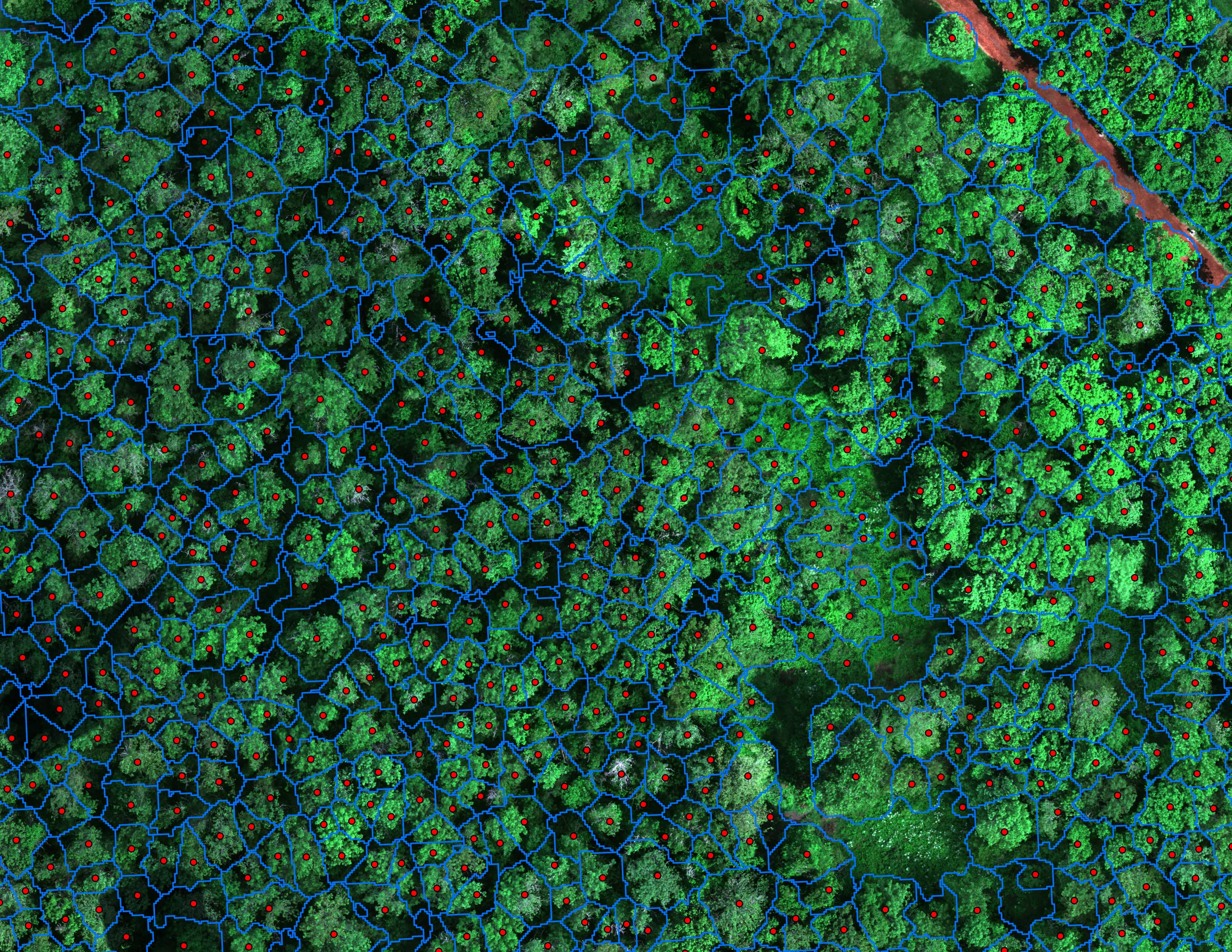
Finding every Oregon ash before the borer does
City of Eugene, Parks and Open Space
12,632 crowns classified across 390 acres of riparian canopy. 5,261 of them Oregon ash.
Read the case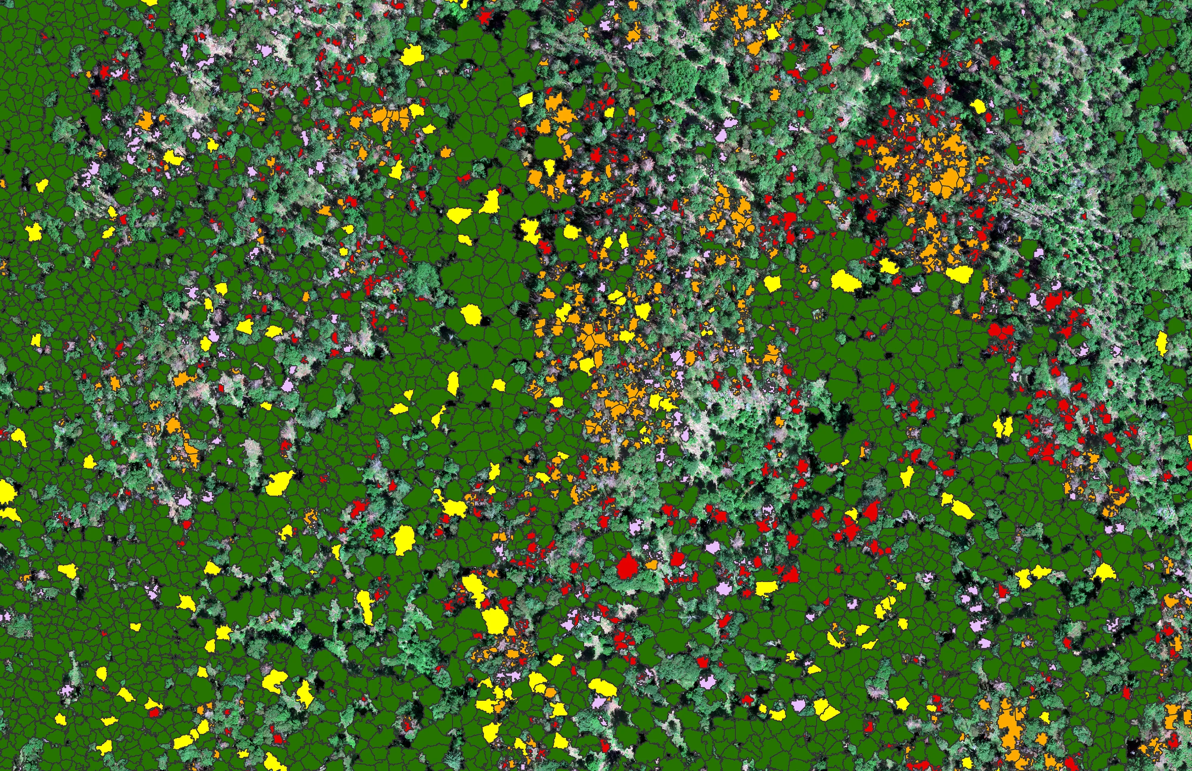
At risk, declining, dieback, dead
City of Ashland
About 30,000 Douglas fir crowns classed by health across the city's watershed lands, so the city could see the die off and act on it.
Read the case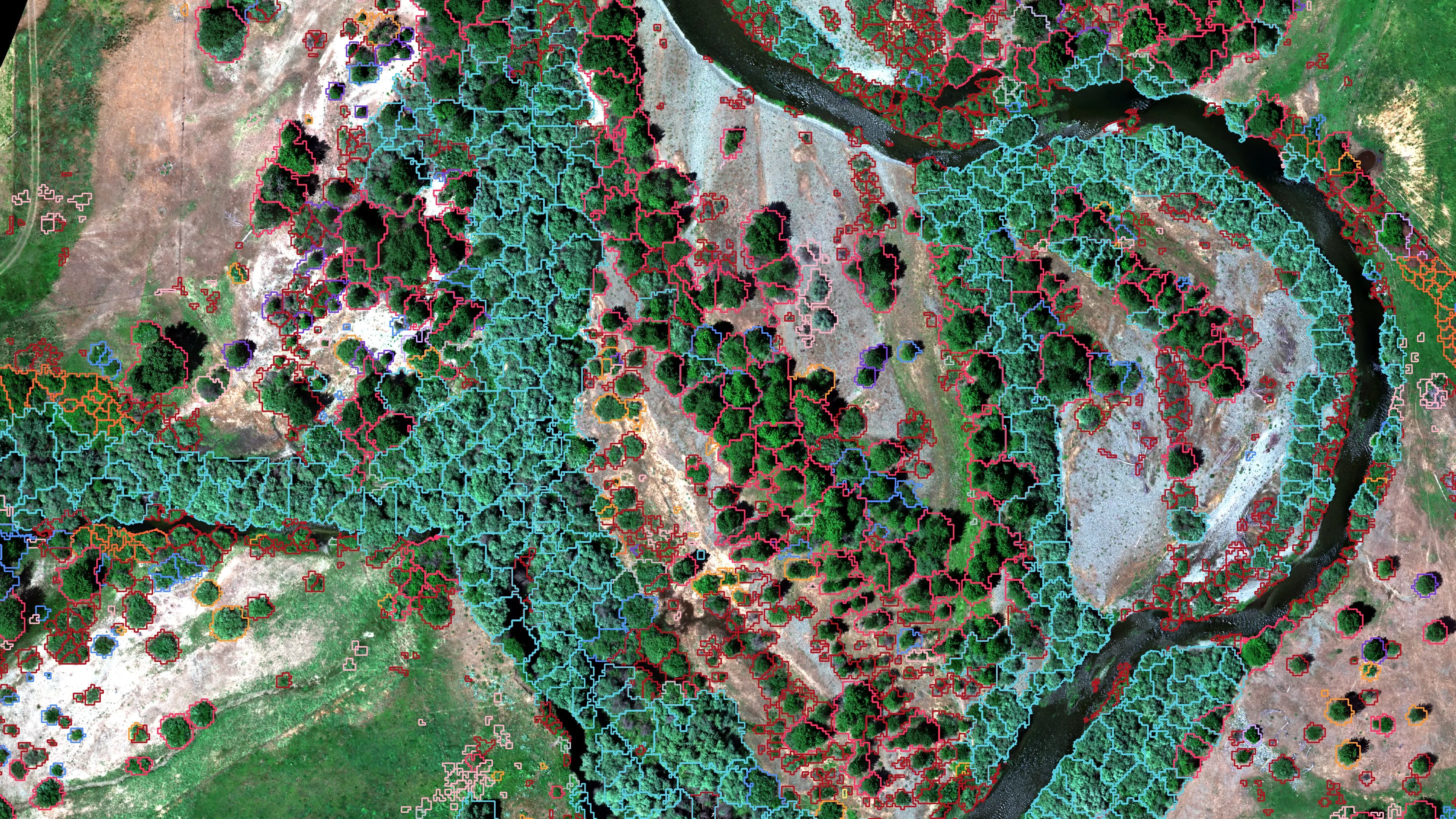
Riparian species and cold seeps on the Scott River
Cascade Stream Solutions, with a botanist leading field identification. We flew it as their subcontractor and reported to them.
Fourteen riparian species classified across 423 acres of river corridor, with thermal mapping that pointed to groundwater fed cold seeps.
Read the caseThe record
Every project we have published
Forestry and trees
- Downed woody debris, measured from the air
- Finding every Oregon ash before the borer does
- At risk, declining, dieback, dead
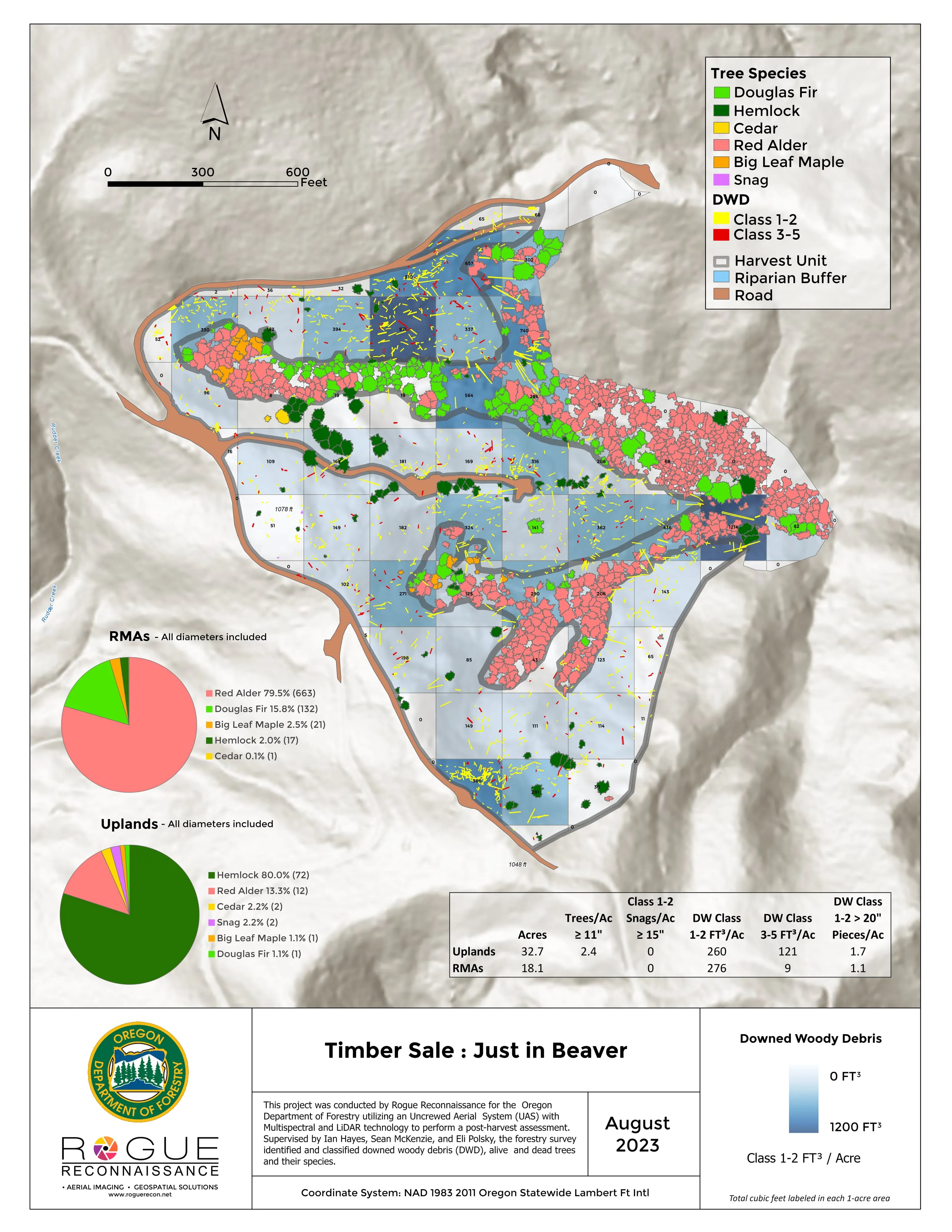
- Post harvest monitoring for ODF
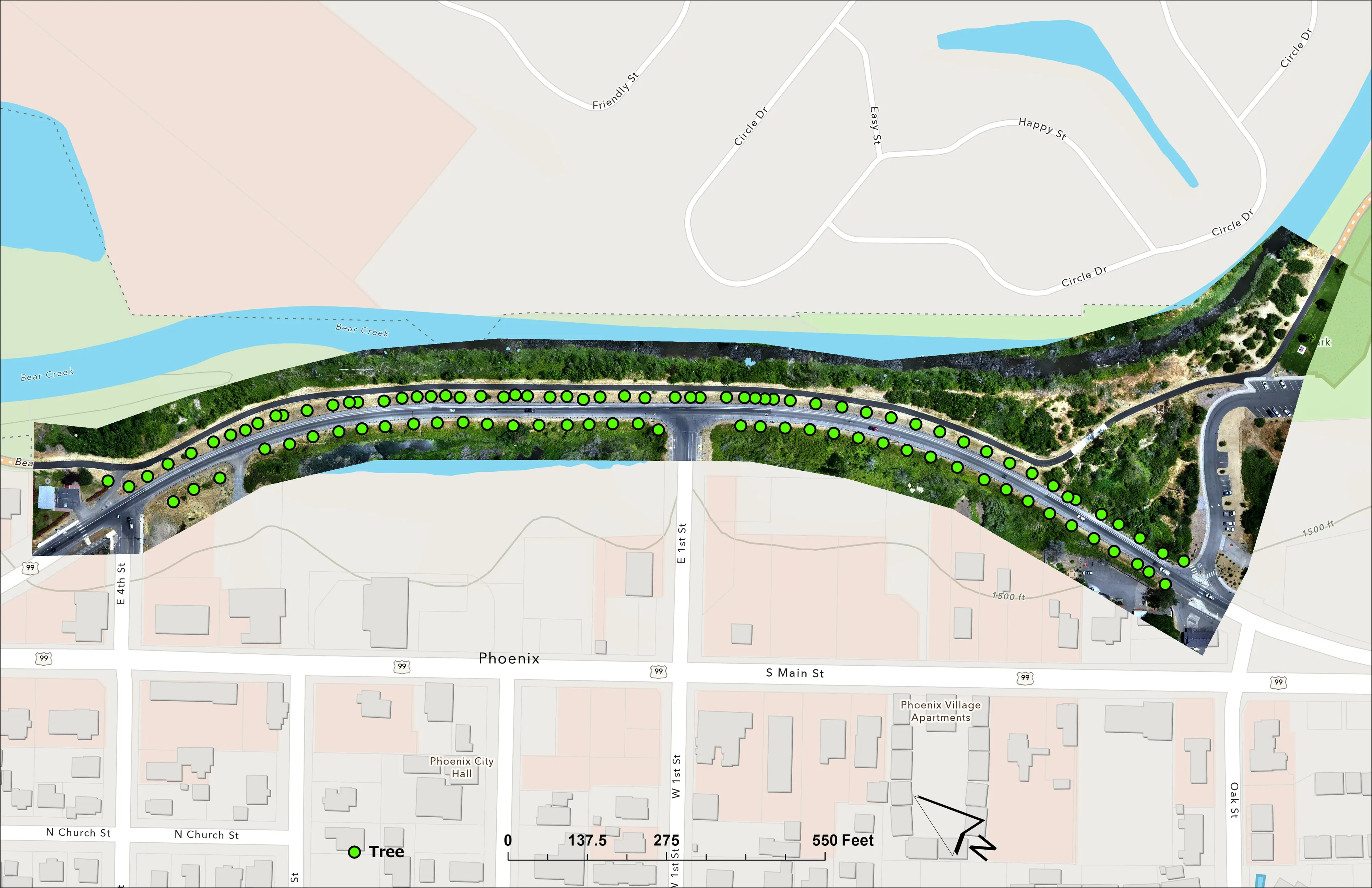
- A planting corridor through Phoenix, tree by tree
Rivers and habitat
- Riparian species and cold seeps on the Scott River
- Ten abandoned mines, bare earth under the chaparral
Wildfire fuels and planning
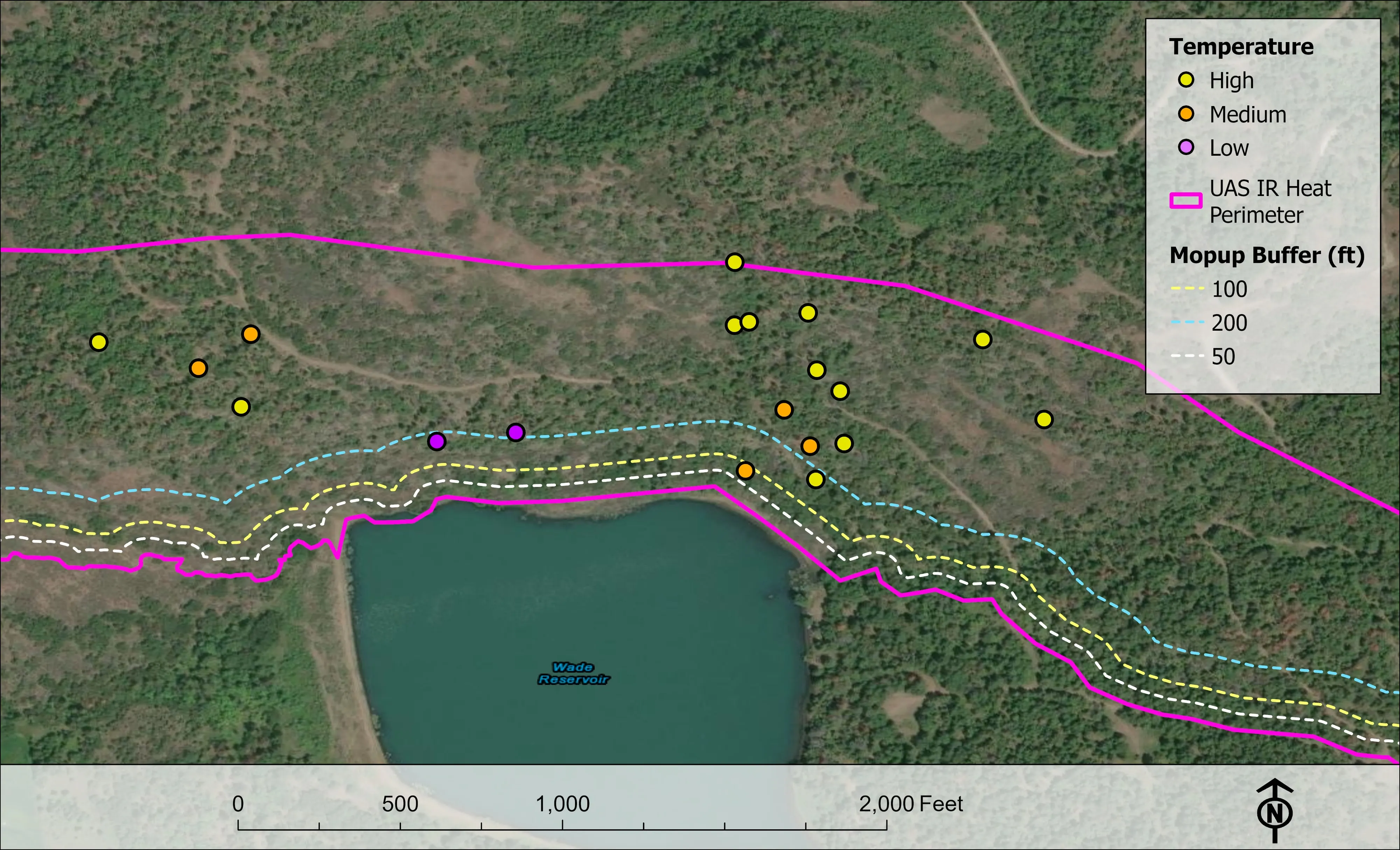
Night infrared on fires
- Night infrared on ODF incidents since 2019
- East Evans Creek, a season inside one fire
- Fielder Mountain, eleven nights as the heat went out
- Woodrat Mountain, from initial attack to the last check
- Interstate 5 at milepost 57, initial attack beside the freeway
- Tyee Ridge Complex
Terrain and site design
Farm planning
Seattle, booked as a week.
A park forest, a watershed stand, a street tree district or a canopy number for the next assessment. Tell us which program is asking and we will build the week around it.
Email info@roguerecon.net or call 808 298 6290.