
Fire mitigation
Fuels mapping the plan can point to
Canopy height, ladder fuels and structure exposure measured from the air, at the scale a city plans on and the resolution a crew works to.
The problem
A plan has to say where the fuels are, parcel by parcel
A Community Wildfire Protection Plan, a defensible space program or a thinning prescription all run into the same wall: somebody has to say where the fuel actually is, in numbers that hold up in a council meeting and survive an appeal. Driving the streets and writing down what you see does not scale to a whole town, and satellite fuel models are built for landscapes, not for the fifteen feet around a house.
Drone LiDAR measures it directly. The pulses that reach the ground give you the terrain, the ones that do not give you the vegetation standing on it, and the difference between them is the fuel. That is one flight producing the canopy structure, the ladder fuel call and the per structure numbers from the same measurement, so they agree with each other by construction.
What the cloud sees
Ladder fuels come out of the vertical structure
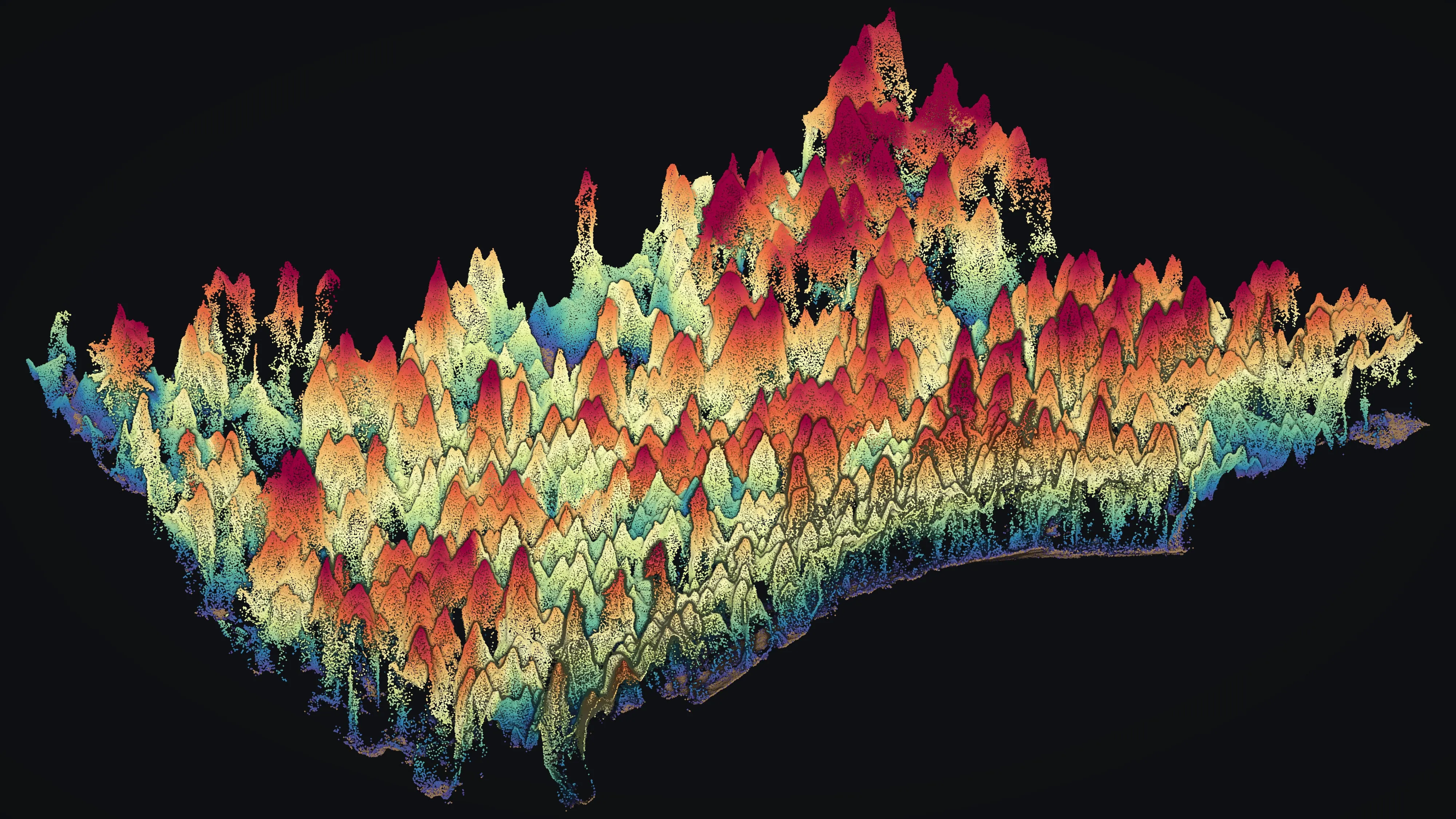
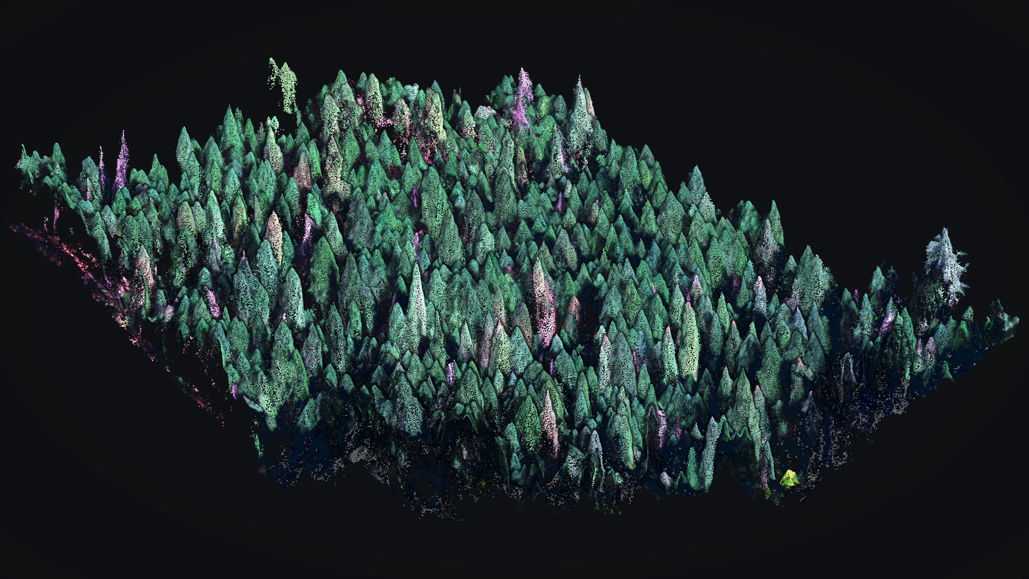
A classified point cloud separates ground, low, medium and high vegetation. That separation is what makes a ladder fuel call possible: the fuel that matters is the stuff between the surface and the crowns, and it is invisible in anything that only measures the top.
The measurement, then the map
Height above ground is the whole game. Once every point carries it, the products fall out: a canopy height model for the stand, a per tree height for the inventory, and the vertical profile that says whether a surface fire in this unit reaches the crowns or lays down.
We report what was measured and what was inferred, separately. A fuels layer that cannot say which is which is not something to write a prescription against.
Structure exposure
Three numbers for every structure in town
The measures the 2025 Ashland Community Wildfire Protection Plan is built on. One flight, one classified cloud, three numbers per structure, delivered into the city's GIS.
Ladder fuels around the structure
What share of the vegetation within the home ignition zone is ladder fuel, the growth that carries a surface fire up into the crowns. Measured per structure from the vertical structure of the point cloud.
Fuels within five feet
What is growing in the five foot zone against the walls, which is the first thing a defensible space assessment looks at and the hardest thing to see from a road.
Canopy over the roof
How much of the roof sits under canopy, so a city can rank blocks and a homeowner can see why theirs came out where it did.
Ashland, 2024 to 2025
A whole town, in 100 acre sections
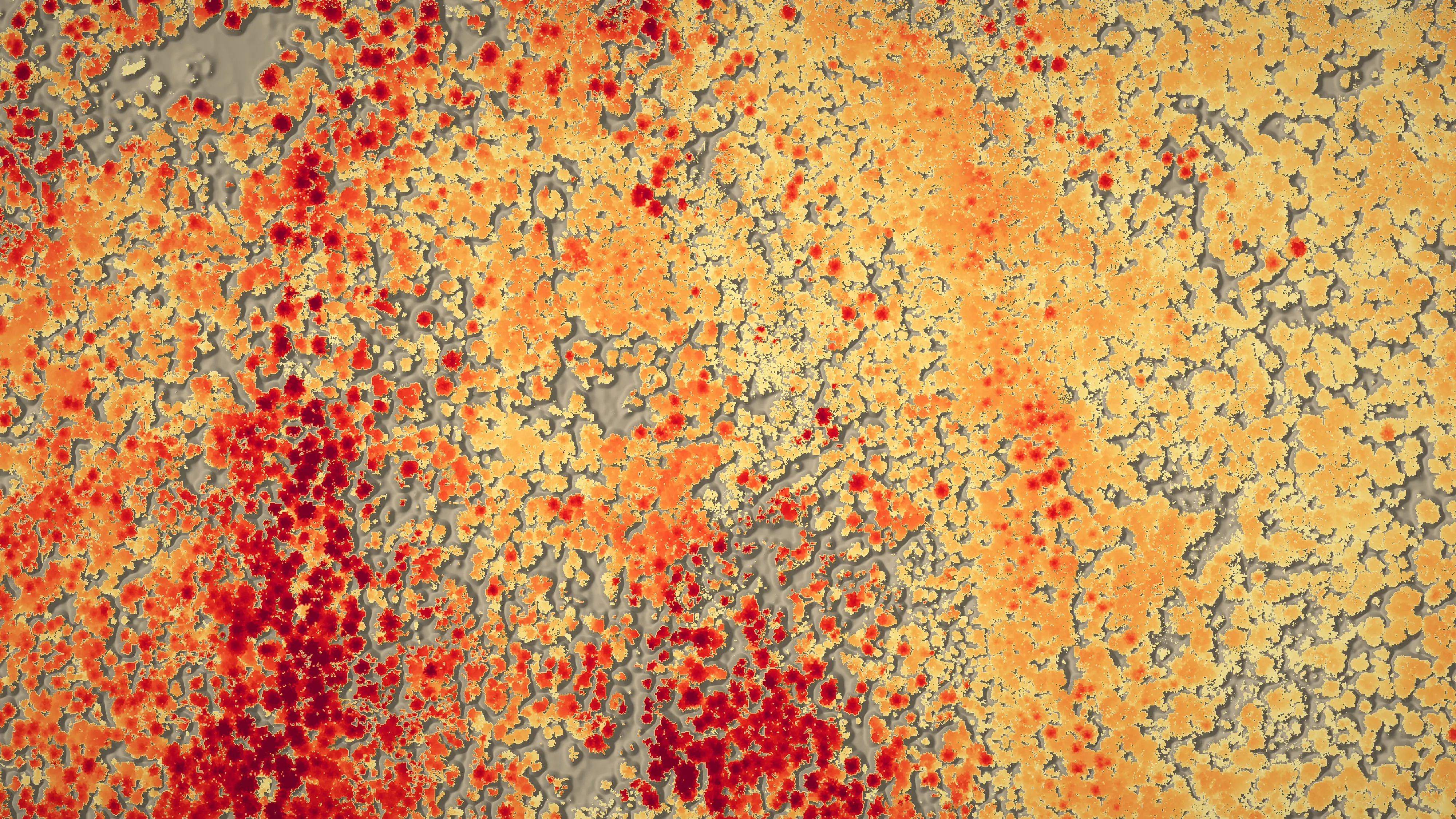
For the City of Ashland we flew about 4,300 acres across the city in 2024, in 100 acre sections over about two and a half weeks, at 250 feet above the ground. It came back as bare earth, surface and canopy height models, individual tree canopy polygons, ladder fuel identification and the three structure exposure measures, delivered into the city's own GIS in support of city staff.
The plan those numbers went into is public, names Rogue Reconnaissance as the aerial LiDAR contractor, describes the acquisition, and draws its fuels and exposure figures from this data. The City Council accepted it on August 19, 2025.
Dead trees are fuel
Mortality is a mitigation question, not only a forest health one
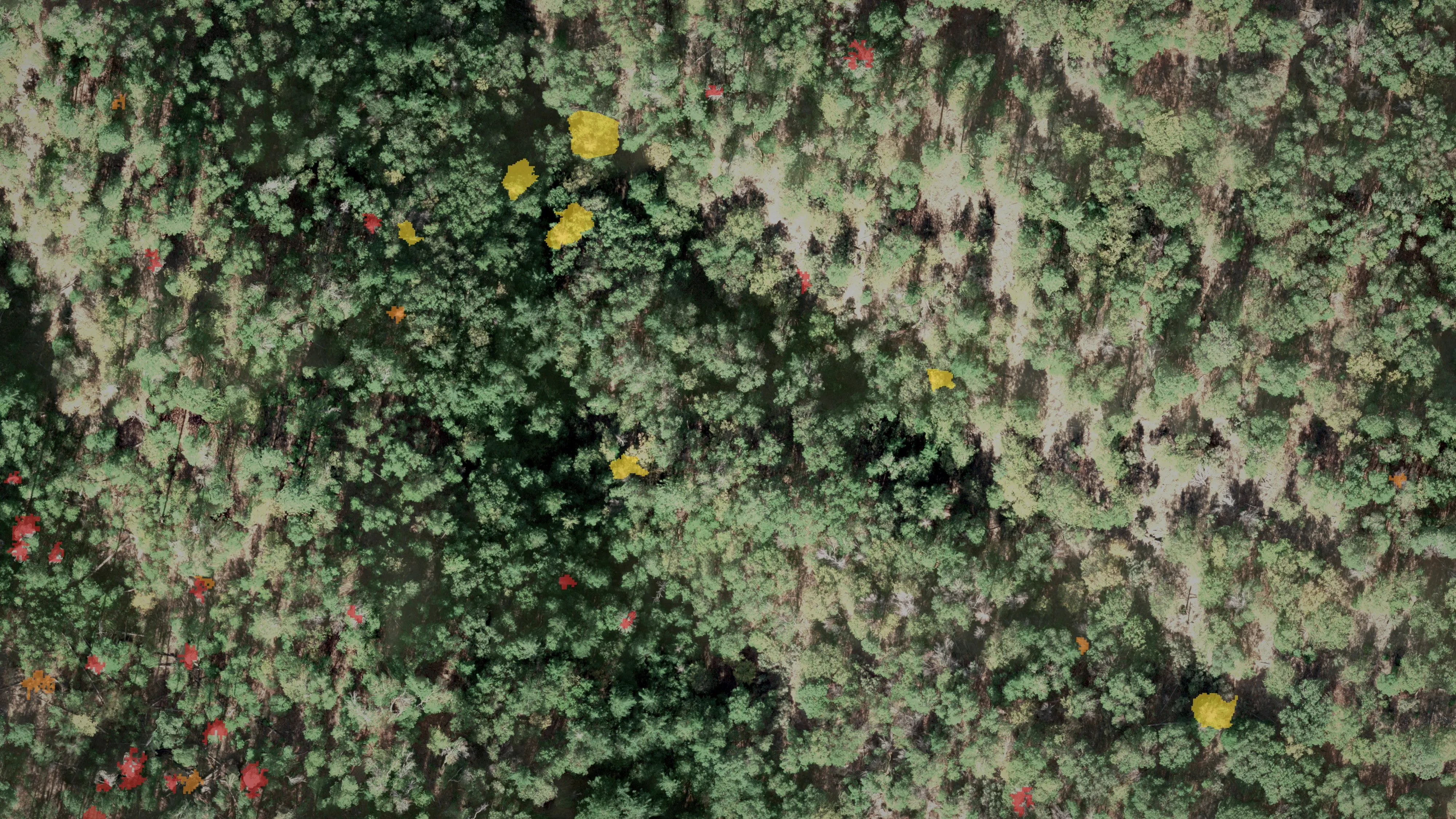
A standing dead tree beside a trail, a road or a house is a hazard tree and it is fuel. The same flight that measures the canopy can classify what is dying in it, which is why the two jobs usually travel together.
What Ashland got
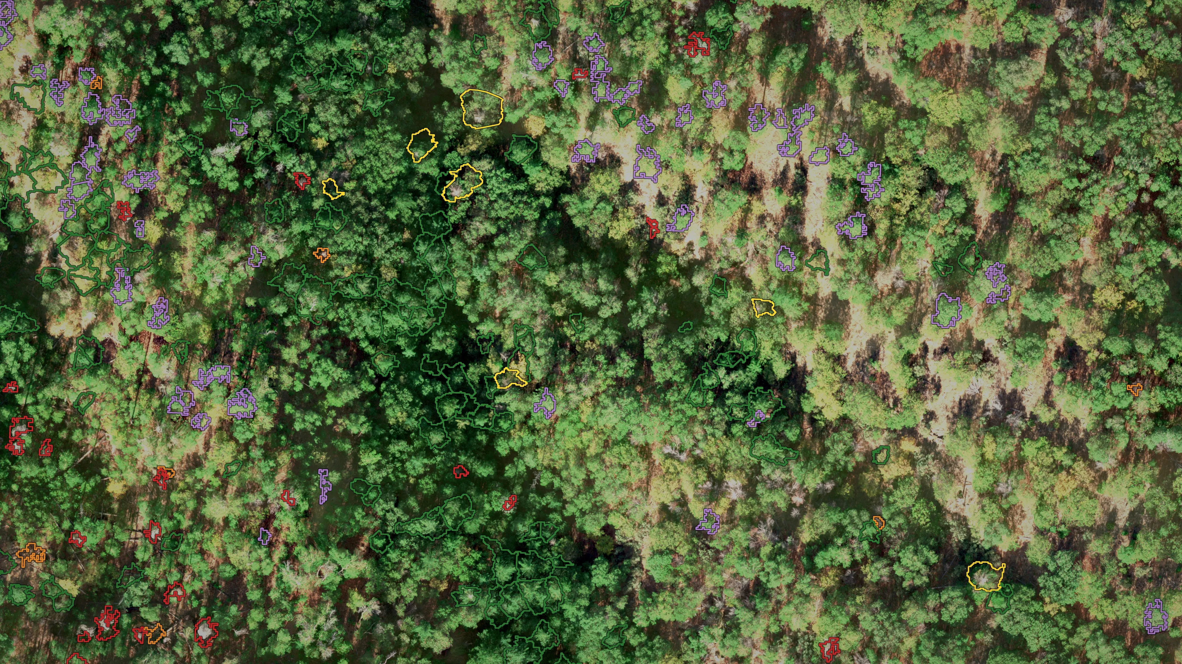
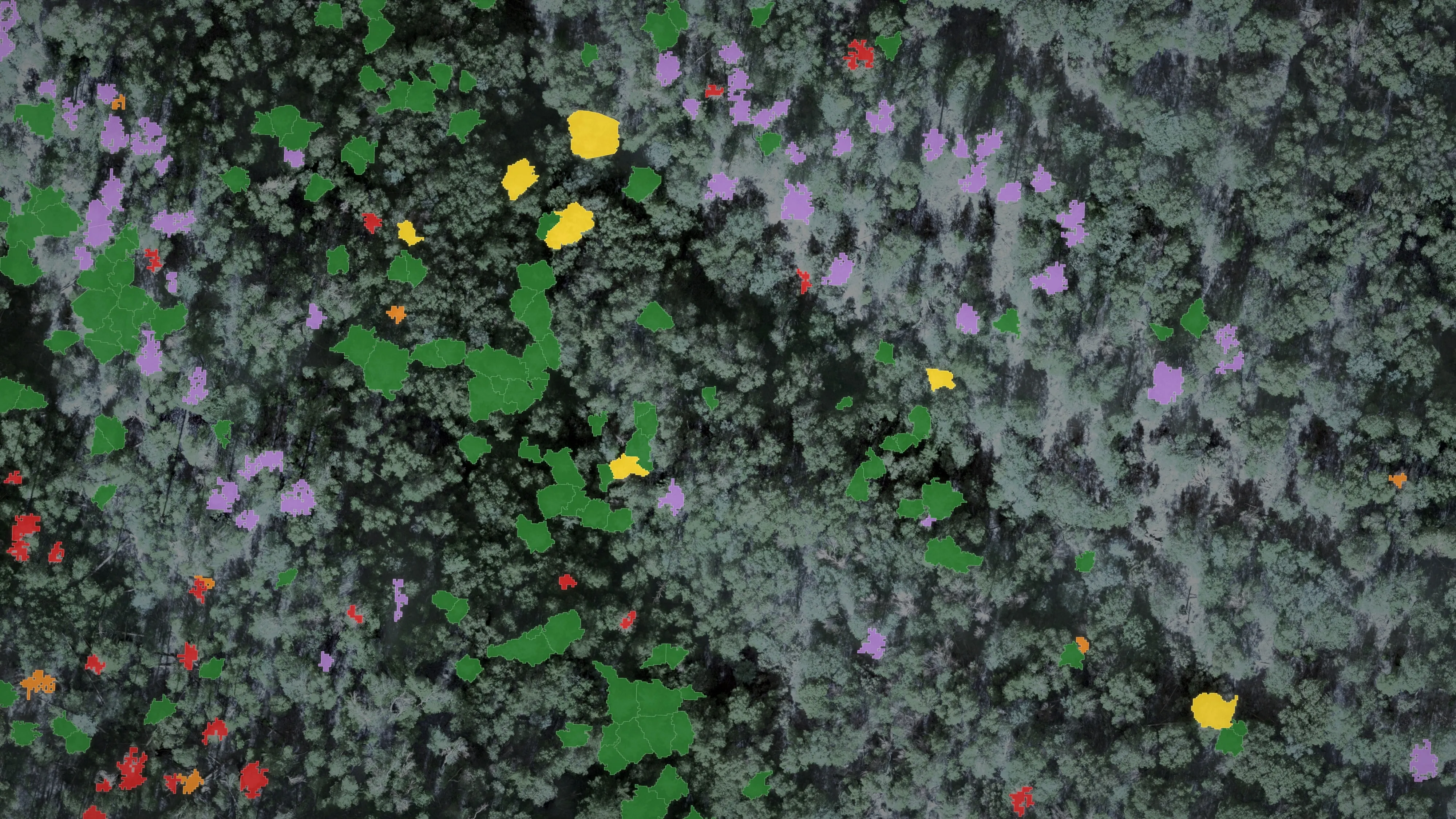
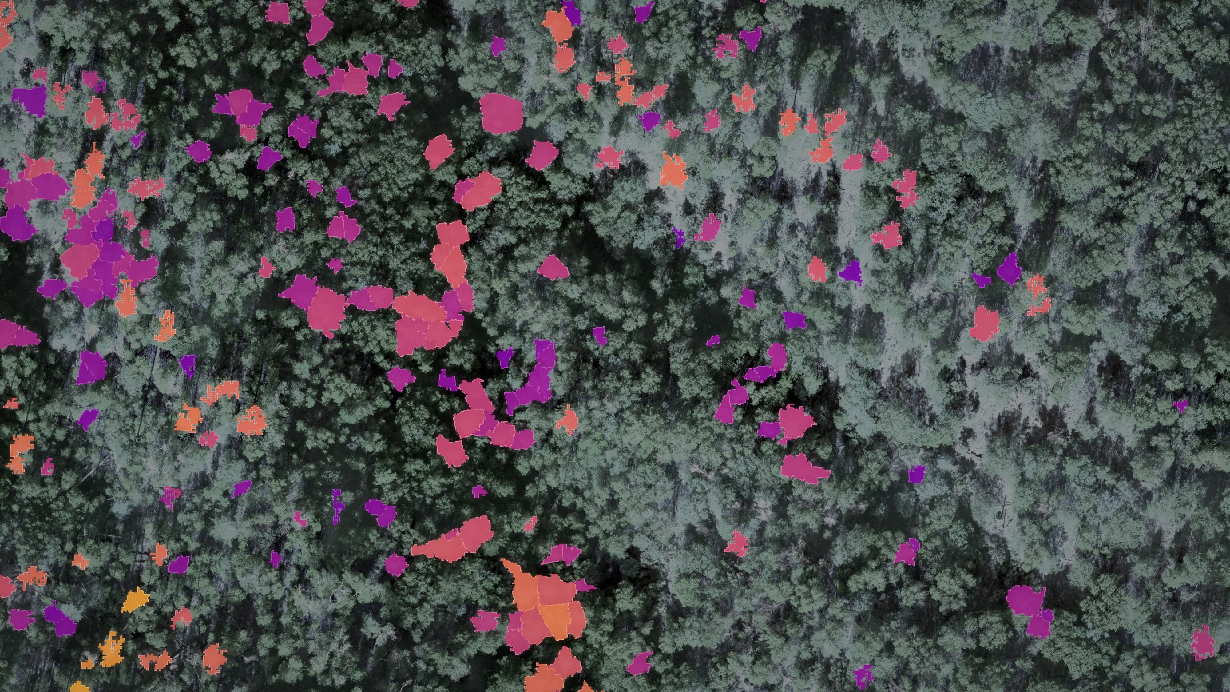
Across the city's watershed lands we classed about 30,000 Douglas fir crowns into four health classes, with ponderosa pine separated out, each crown carrying its species and height, with a tally per area and a geodatabase the city's GIS staff work from. The city published the 2023 findings and acted on them: dead trees came out by helicopter on about 400 acres in the spring of 2024.
The Ashland Douglas fir assessment Ashland News on the findings

How it looks when it lands
The same stand, measured three ways
What you get
Deliverables
- Classified point cloud: ground, low, medium and high vegetation
- Bare earth, surface and canopy height models
- Individual tree canopy polygons with height
- Ladder fuel identification from the cloud, not from a guess at the canopy
- Structure exposure per structure, the three measures above
- Tree health classes where a mortality question rides along
- Everything delivered into your GIS, in the schema your staff already work in
Who it is for
- Cities and counties writing or updating a Community Wildfire Protection Plan
- Fire districts and defensible space programs that need to rank blocks
- Watershed councils and land trusts with a fuels problem on their ground
- Foresters and fuels contractors writing prescriptions
- Utilities and road authorities with hazard trees along a corridor
Flying the ground before the work and again afterward is the cheapest way to show a funder what changed. Say so at the start and the first flight is designed for it.
The other side of it
And when it is already burning
Everything above happens before there is any smoke. Once a fire is running the job changes: a night infrared flight, heat classified from measured temperature, a perimeter and isolated heat sources in the schema the incident's GIS specialist expects, in their hands before the morning briefing.
Send us the ground and the question.
A boundary, roughly how many acres, and what the plan has to say. We will come back with a flight and what it would give you.
Email info@roguerecon.net or call 808 298 6290.