
Rogue Reconnaissance
Contact

Forestry

Riparian species and cold seeps on the Scott River

Fourteen riparian species classified across 423 acres of river corridor, with thermal mapping that pointed to groundwater fed cold seeps.

Client
Cascade Stream Solutions, with a botanist leading field identification. We flew it as their subcontractor and reported to them.
Location
Scott River, California
Years
2025
Lane
Forestry

The problem

Restoration partners needed to know what was growing along the river and where the water stayed cool in summer, the two things that decide fish habitat, at a scale a field crew cannot walk.

What we flew

  • MicaSense RedEdge MX multispectral at 399 feet, 8 cm ground resolution
  • DJI H20T thermal at 399 feet, 10.5 cm ground resolution, morning and afternoon on separate days
  • DJI P1 RGB at 328 feet, 2.2 cm, for review and outreach
  • Georeferenced to crewed aircraft LiDAR, about 1.5 feet horizontal

What we delivered

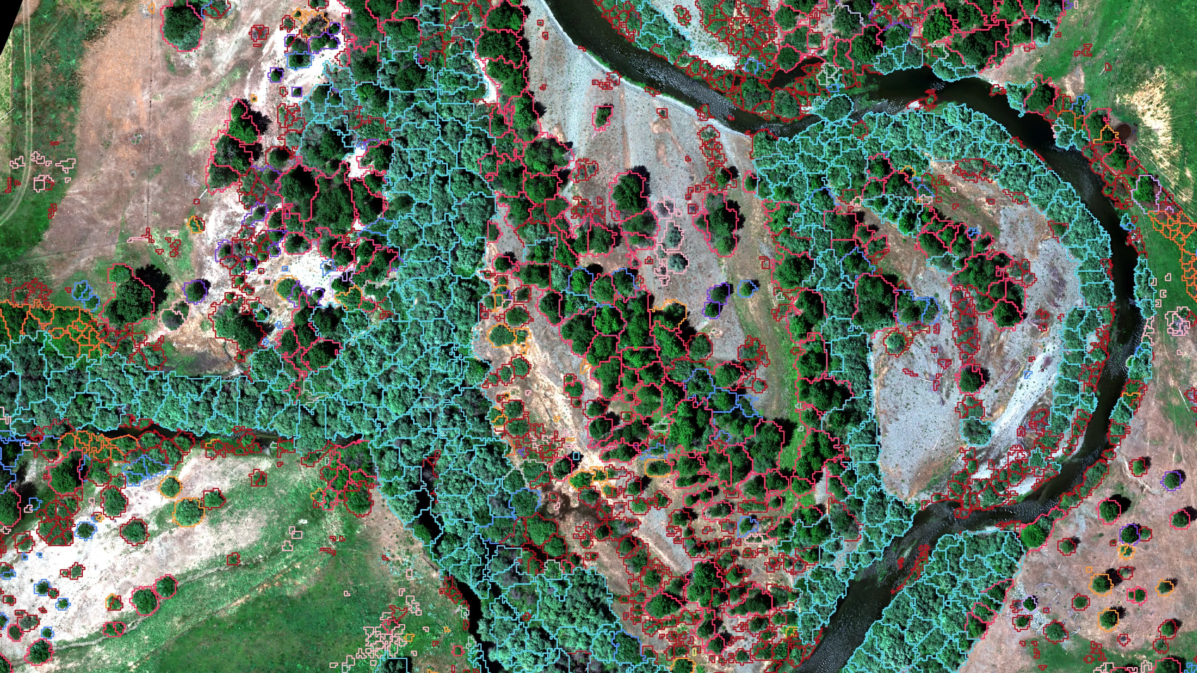
  • Canopy polygons with tiered species, the most likely species first, for 14 classes
  • Multispectral, NDWI, thermal, and RGB orthomosaics as GeoTIFF
  • Relative elevation model with one foot contours from the LiDAR
  • 20 foot thermal temperature grid and potential cold seep points
  • Classified water, river centerline, and the field sample lines used to train the model
  • An ArcGIS Experience Builder viewer the botanist used to review and correct species calls
  • Written report with method, accuracy, limits, and recommendations

Fourteen species is a hard problem for a classifier. Willows overlap spectrally, canopies overlap physically, and some species had only a handful of samples. The tiered output handles that: every polygon carries its first, second, and third most likely species, and the report says which classes were weak and why.

We flew this job as a subcontractor to Cascade Stream Solutions, who ran the restoration side and were the people we reported to.

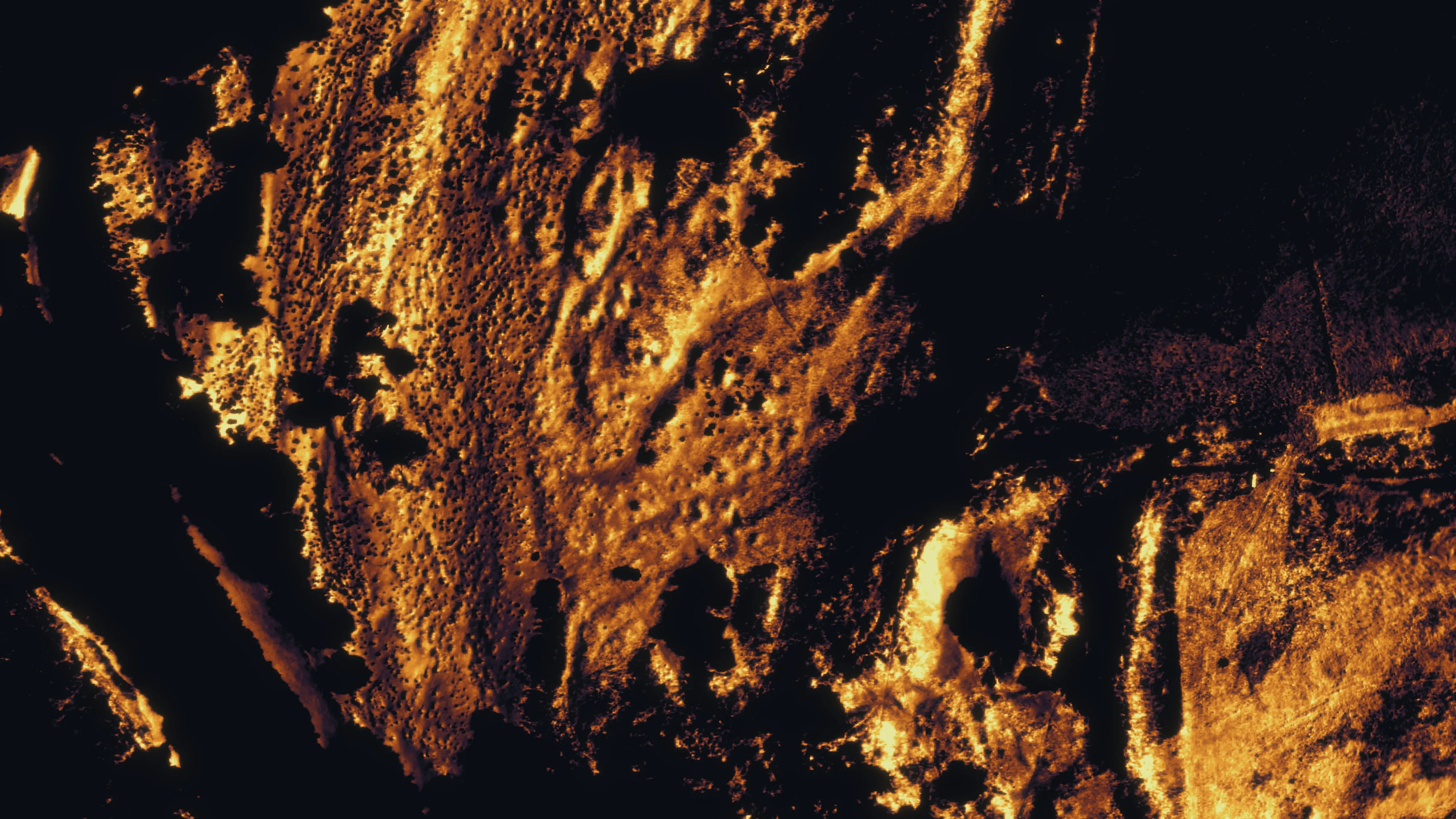
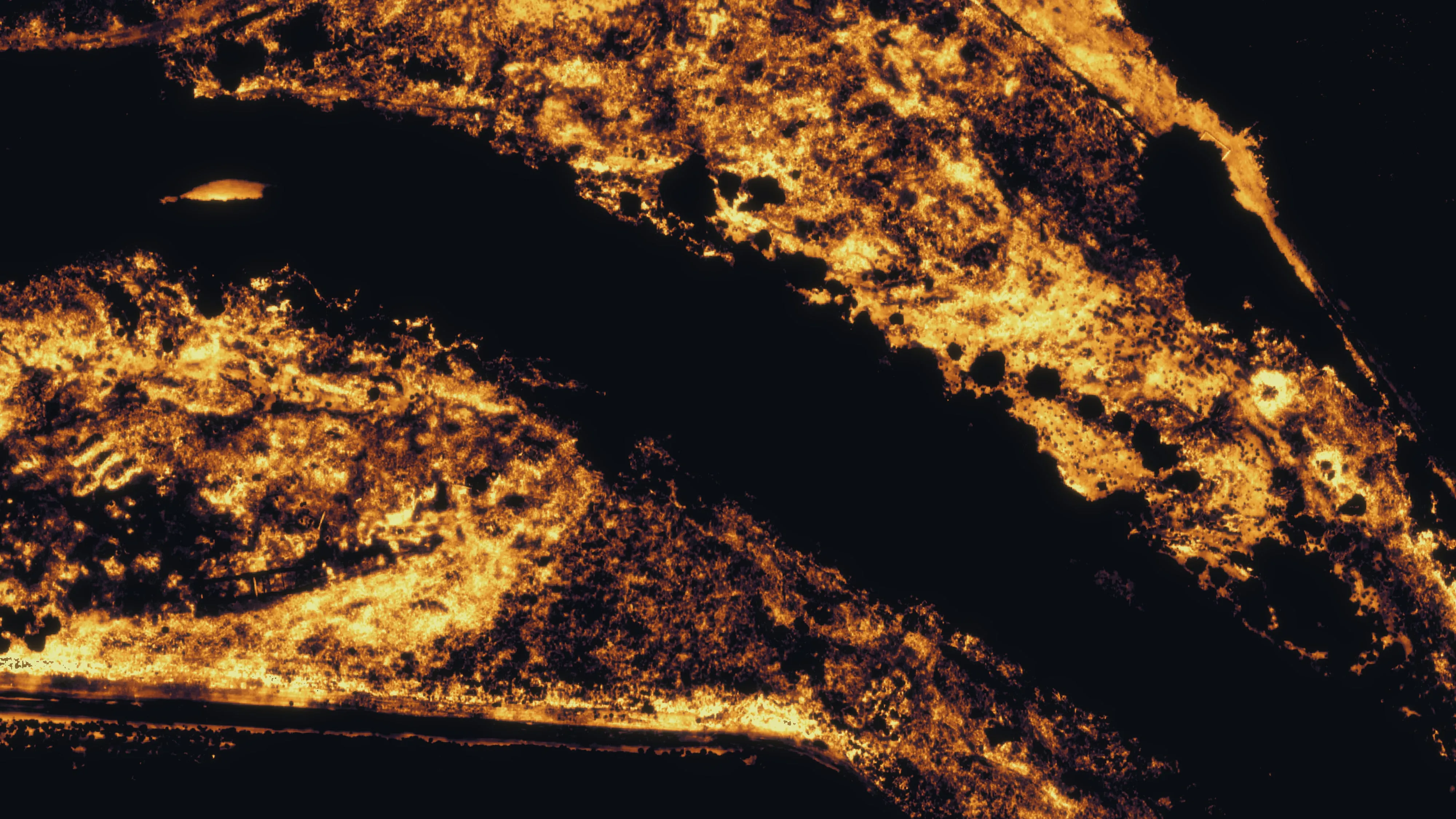
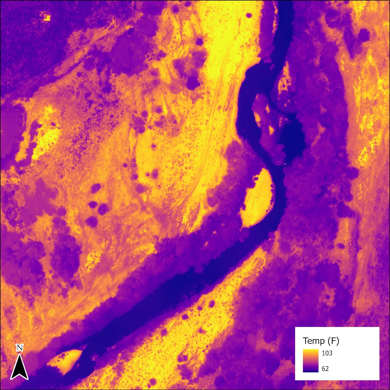
The thermal work is read as relative temperature. An ice water calibration was attempted, the flight altitude still introduced swings, so the products highlight cooler and warmer zones rather than claiming a surface temperature to the degree. That is enough to find a seep. It is not a surface temperature to the degree, and we do not sell it as one.
Riparian canopy polygons drawn as coloured outlines by dominant species over a true colour orthomosaic of a river corridor.
Canopy polygons by dominant species.
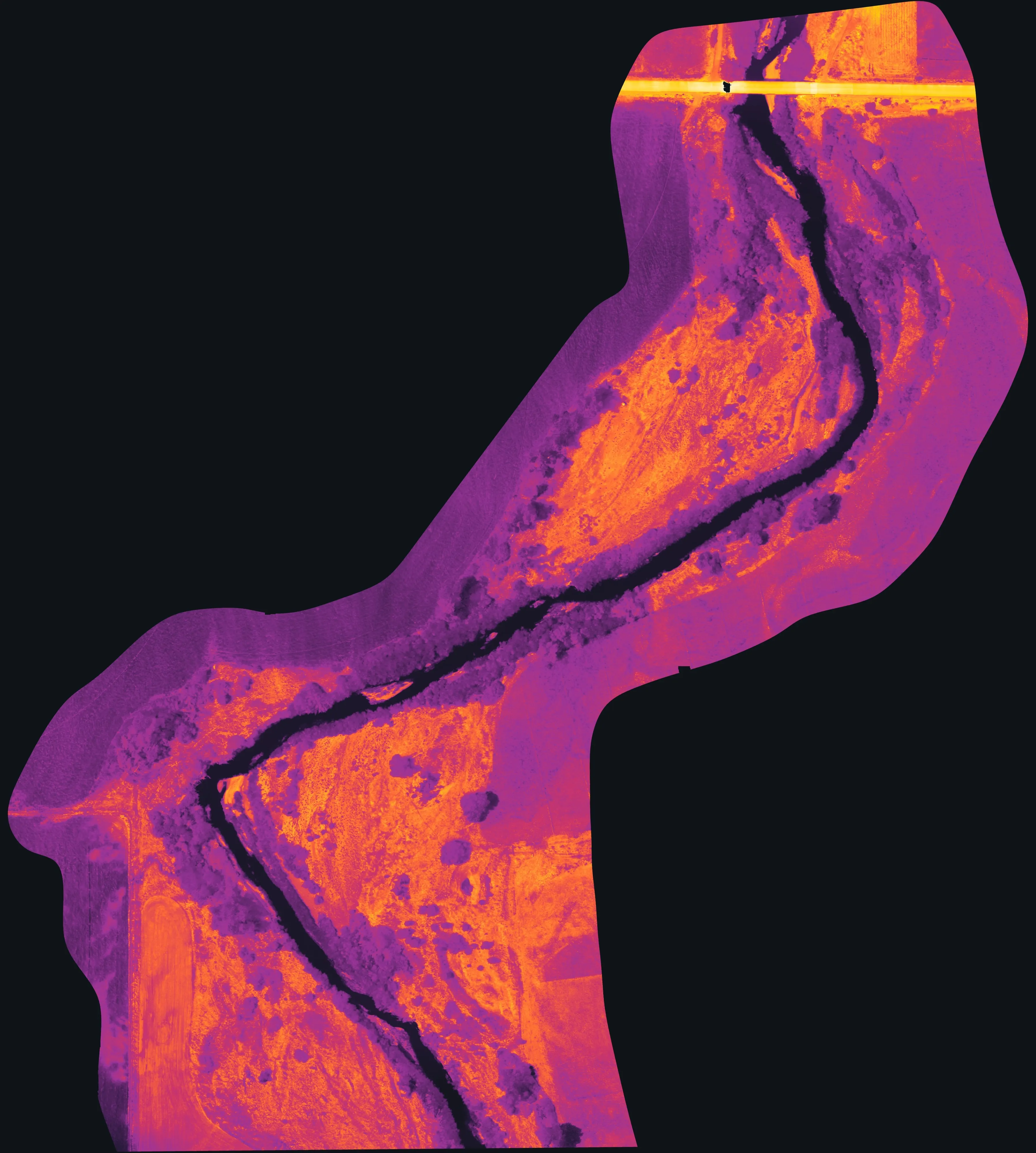
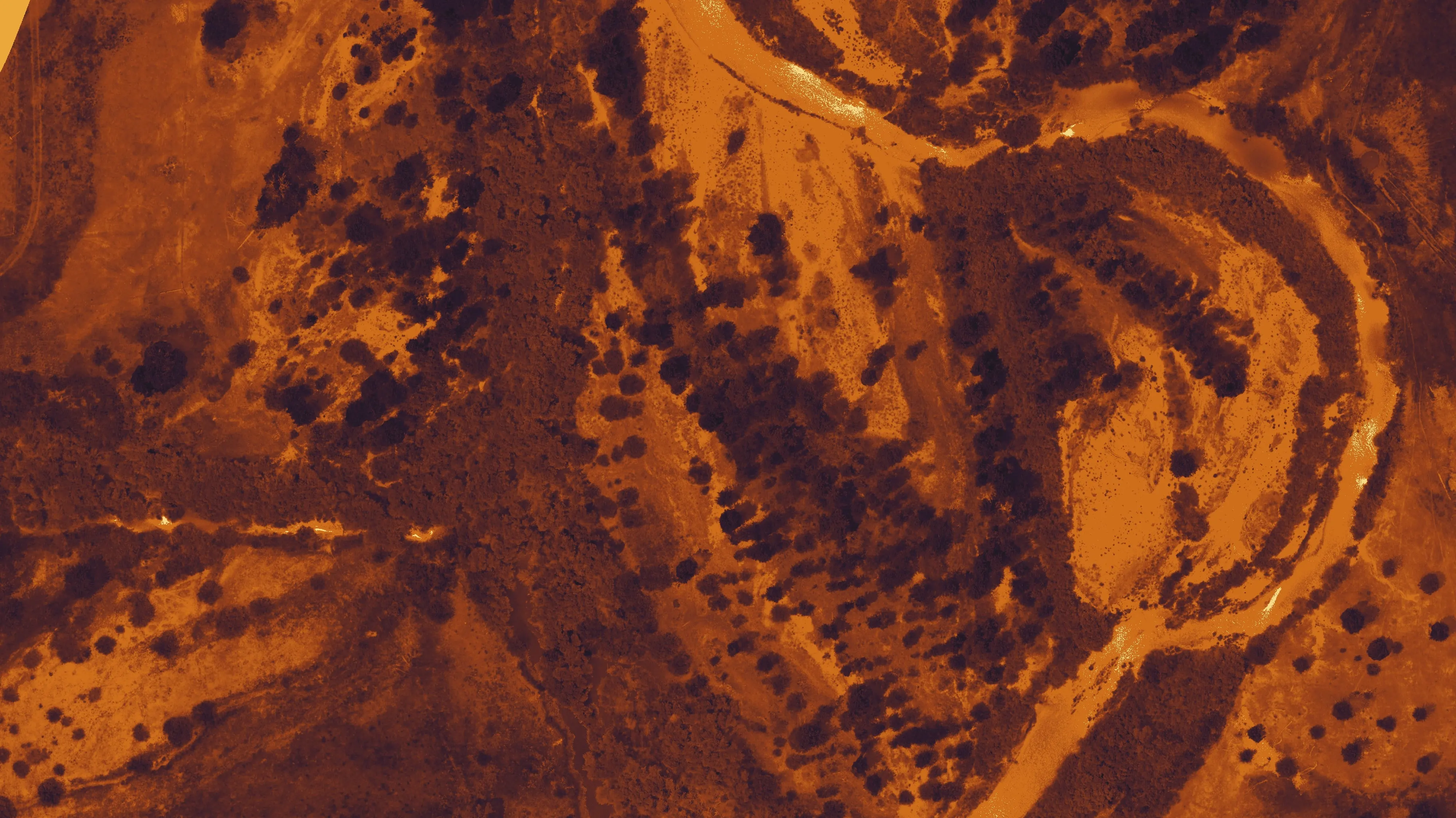
Afternoon thermal mosaic, the river channel dark and cool against warm ground.
Afternoon thermal mosaic. The cooler zones in the channel are the candidates for groundwater inflow.
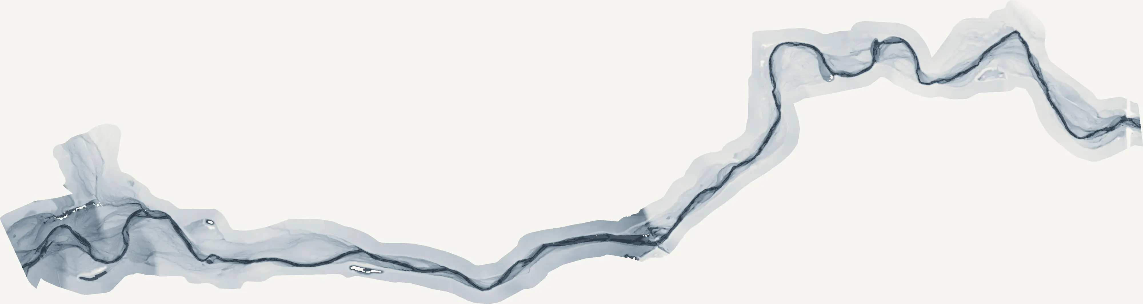
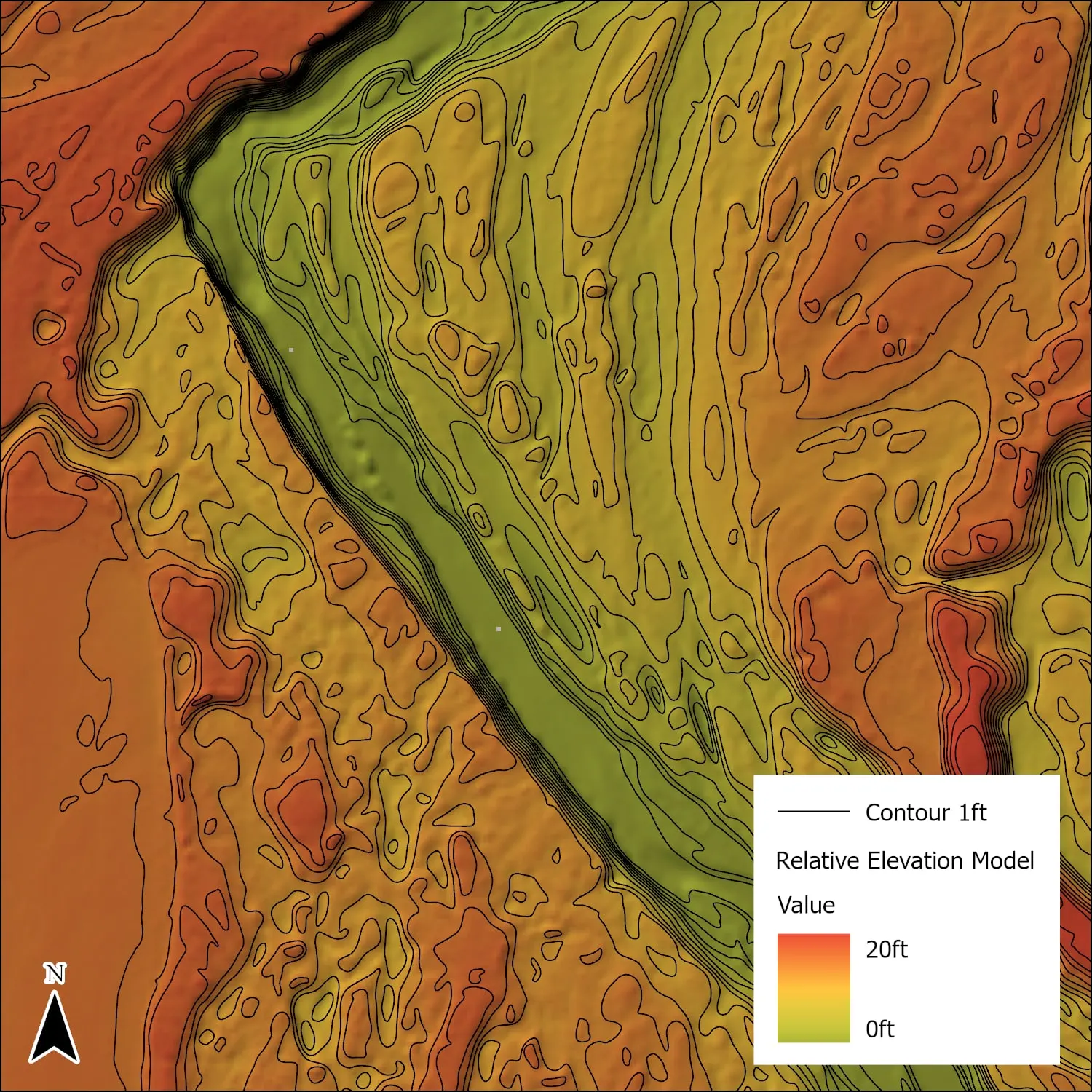
Relative elevation model with one foot contours across the floodplain.
Relative elevation model with one foot contours, the micro topography that moves water and seeds.
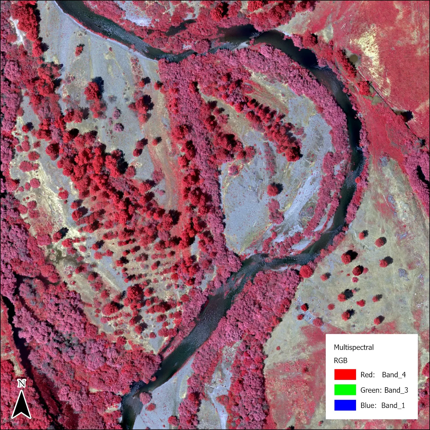
Multispectral mosaic of the reach with crowns outlined.
Multispectral mosaic of the reach.
Thermal orthomosaic of a river reach: the channel reads dark and cool, gravel bars and open ground glow orange and yellow.
One section of the relative temperature raster, rendered straight from the data. Water reads dark and cool, gravel bars warm.
Relative elevation model of a river reach: the channel in dark ink, floodplain surfaces stepping up through grey to the valley floor.
The relative elevation model as a raster, height above the channel from zero to twenty feet.
Afternoon thermal mosaic of a river reach: the channel dark and cool, bars and open ground warm, cool tongues along the bank.
Afternoon thermal on a second reach, rendered straight from the temperature raster. The channel reads dark and cool, the bars and open ground warm. The cool tongues along the bank are the candidates for groundwater inflow.
Morning thermal mosaic of the first reach, the same ground as the afternoon flight, cooler bars and the same dark channel.
The morning flight over the first reach. What stays cool in both flights is a candidate cold seep. What only looks cool in the afternoon is shade.
Afternoon thermal mosaic of a third reach, warm bars in gold and the cool channel dark.
Afternoon thermal on a third reach. Every cool pocket on these three sections went to the botanist and the project manager as a point to check on the ground.
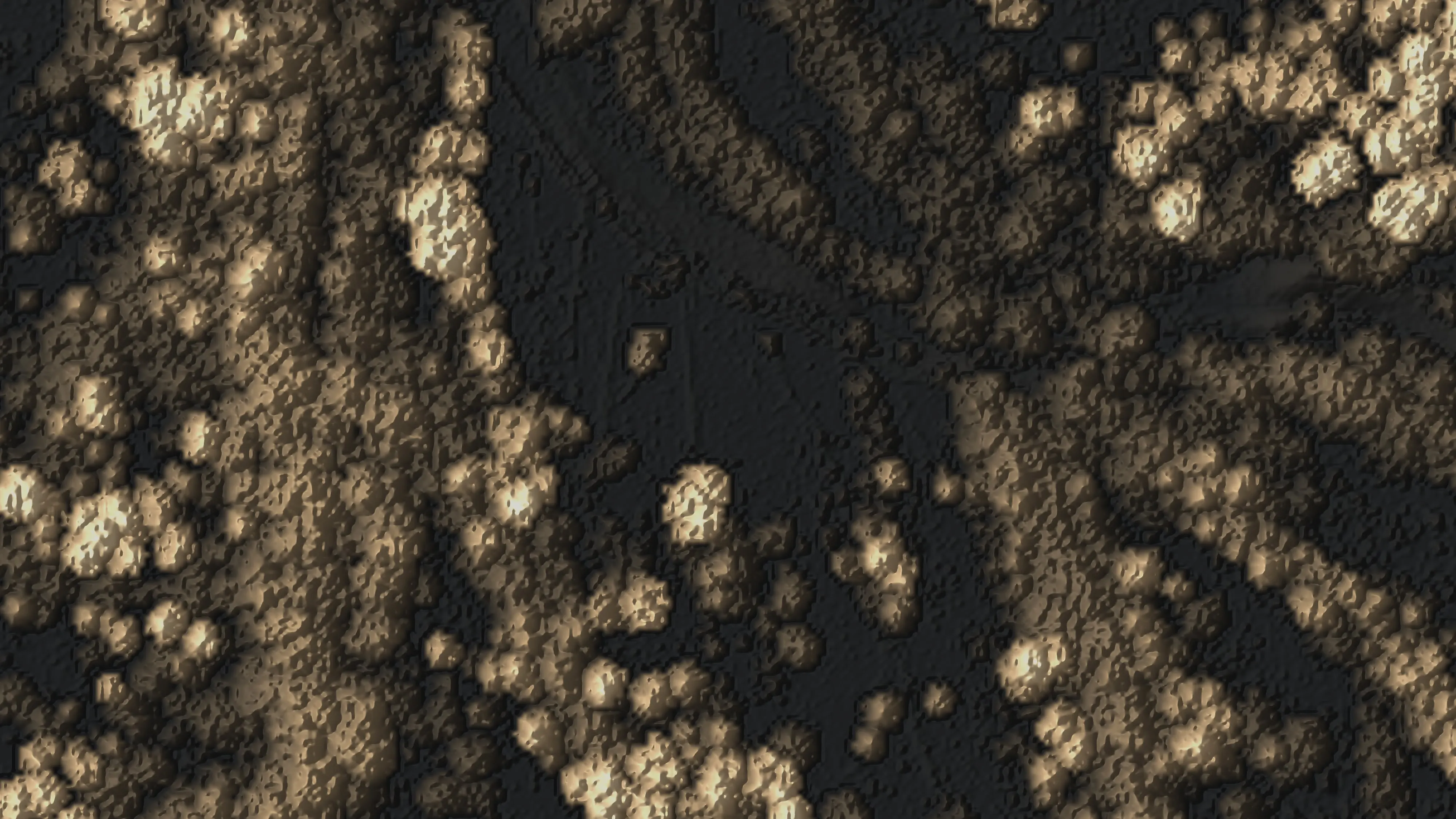
Canopy height model of the river corridor, every crown standing in relief and toned by height.
Canopy height from the LiDAR, every crown standing in relief. Height is what separates a willow thicket from a cottonwood gallery before the species model runs.
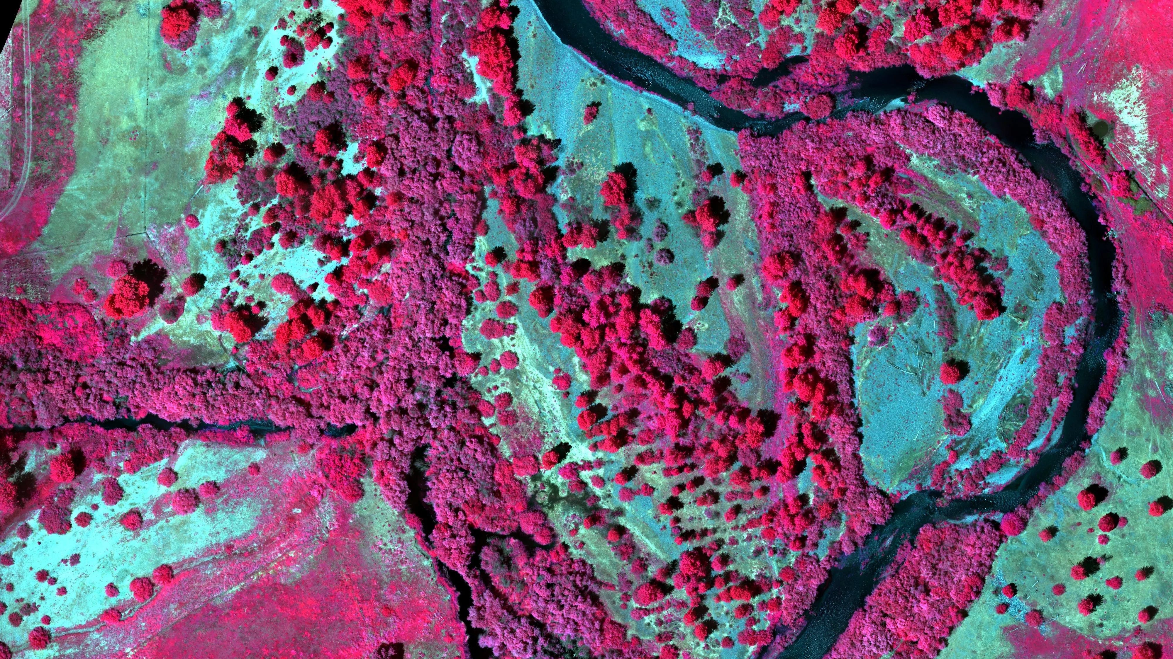
Colour infrared orthomosaic of the river corridor: canopy in magenta, gravel bars in cyan, the channel dark.
Colour infrared from the five band multispectral flight, live canopy in magenta, gravel in cyan, the channel dark. This is the imagery the species model was trained on.
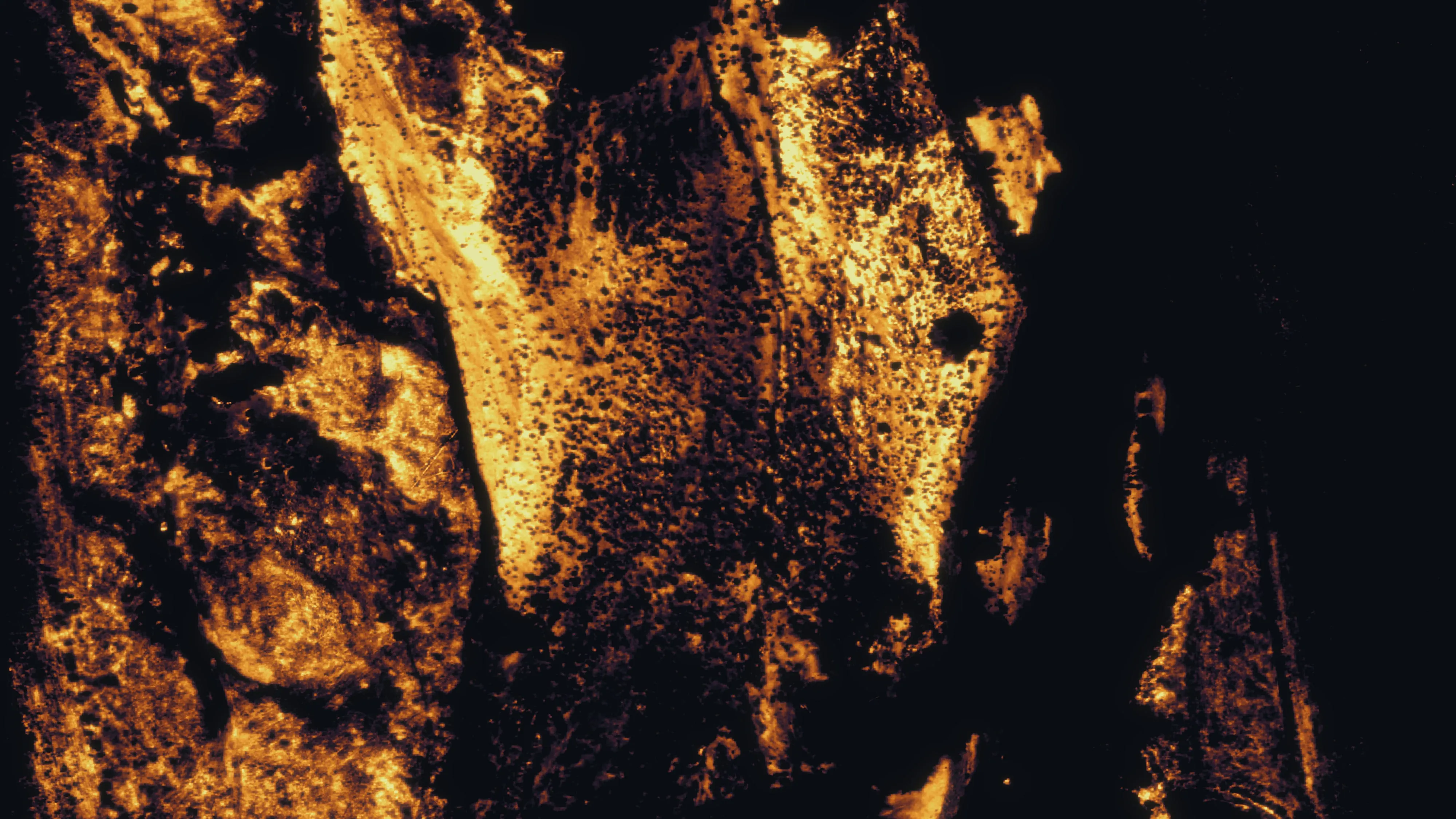
Water index of the river corridor, the wetted channel and side channels dark against gold ground.
The water index from the same flight, water dark and dry ground gold. It draws the wetted channel and the side channels the eye misses in true colour.

Let's talk about your stand.