

Ashland, Oregon
The town whose wildfire plan runs on our LiDAR.
For the City of Ashland we flew about 4,300 acres across the city in 2024, delivered canopy height, ladder fuels and three structure exposure measures into the city's GIS, and classed 30,226 Douglas fir crowns by health across the watershed lands. The 2025 Community Wildfire Protection Plan names the company and draws its numbers from this data.
The ground
Ashland and Jackson County
Ashland climbs from Bear Creek into the Siskiyous: the plaza and the university on the valley floor, neighbourhoods up the draws, and above them the Ashland Creek watershed that feeds Reeder Reservoir and the city's water. The watershed is Douglas fir and mixed conifer that has been dying in patches since the drought years, and it is where the Ashland Forest Resiliency partners have been thinning and burning for over a decade. Mount Ashland stands at the top of it all.
Who buys mapping here
- City of Ashland: Fire and Rescue, Public Works, Parks, the Electric utility and the GIS staff who already work from our layers
- Ashland Parks and Recreation Commission and the parks and trails in the interface
- The Ashland Forest Resiliency partners: the city, the Rogue River Siskiyou National Forest, Lomakatsi Restoration Project and The Nature Conservancy
- Southern Oregon University and its grounds
- Talent and Phoenix next door, rebuilding after the Almeda fire
- Homeowner associations on the hillside neighbourhoods and the defensible space programs that serve them
Getting there
From Medford
Twenty minutes from Medford. The Ashland watershed is the stand we know best.
The public lidar
What exists, and what it misses
Ashland does not have to rely on the public lidar any more: the city holds the 2024 citywide dataset we flew, classified and delivered, and the 2023 and 2024 crown health layers. The next question is change: the same ground flown again to show what the treatments and the removals did, and what died since.
What we would fly
The lanes that fit Ashland
Nearest work
The Ashland work, and the planting corridor two towns down the creek.
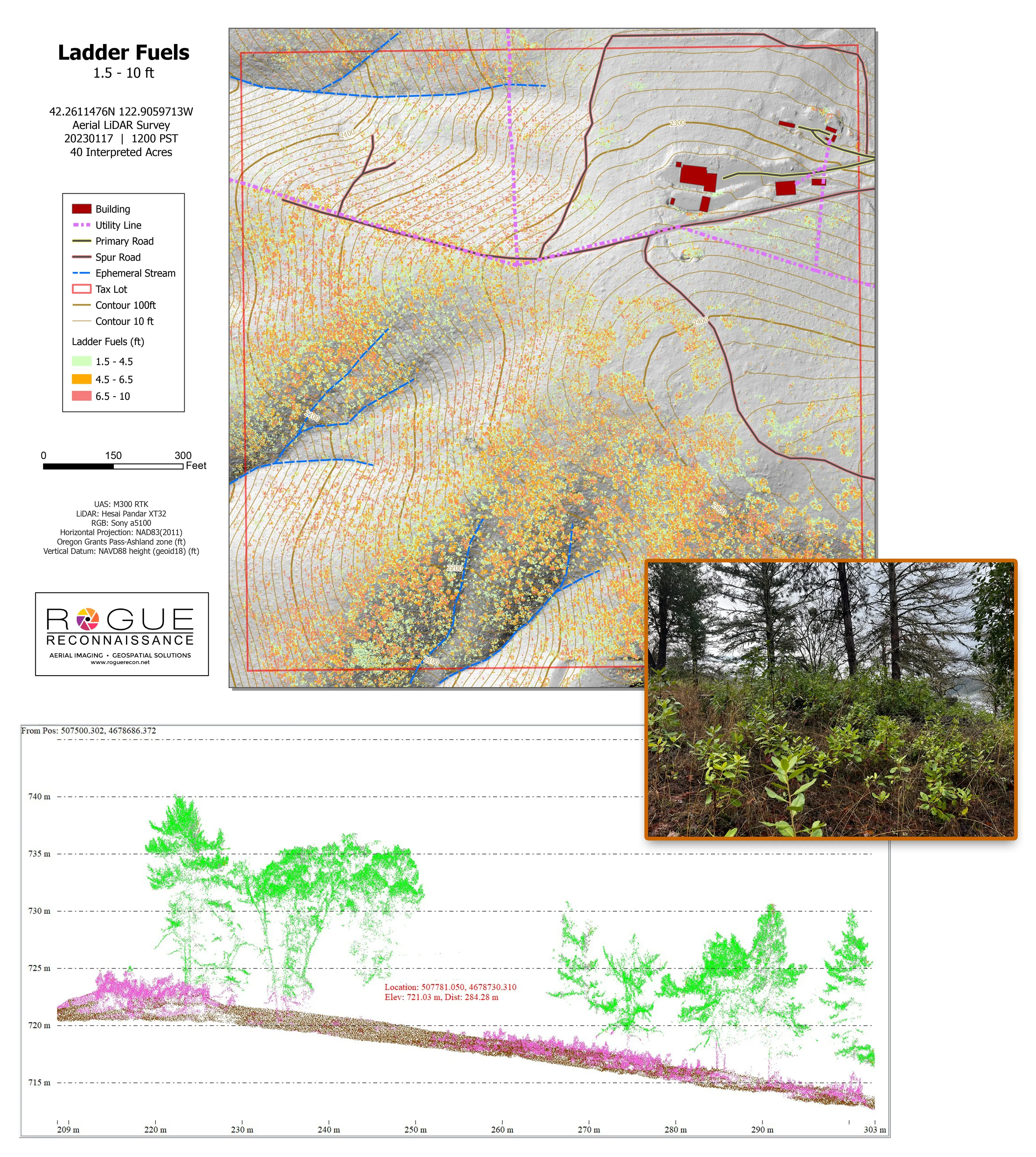
Citywide LiDAR for the Ashland CWPP
City of Ashland
Citywide drone LiDAR that gave the 2025 Ashland Community Wildfire Protection Plan its ladder fuel and structure exposure numbers.
Read the case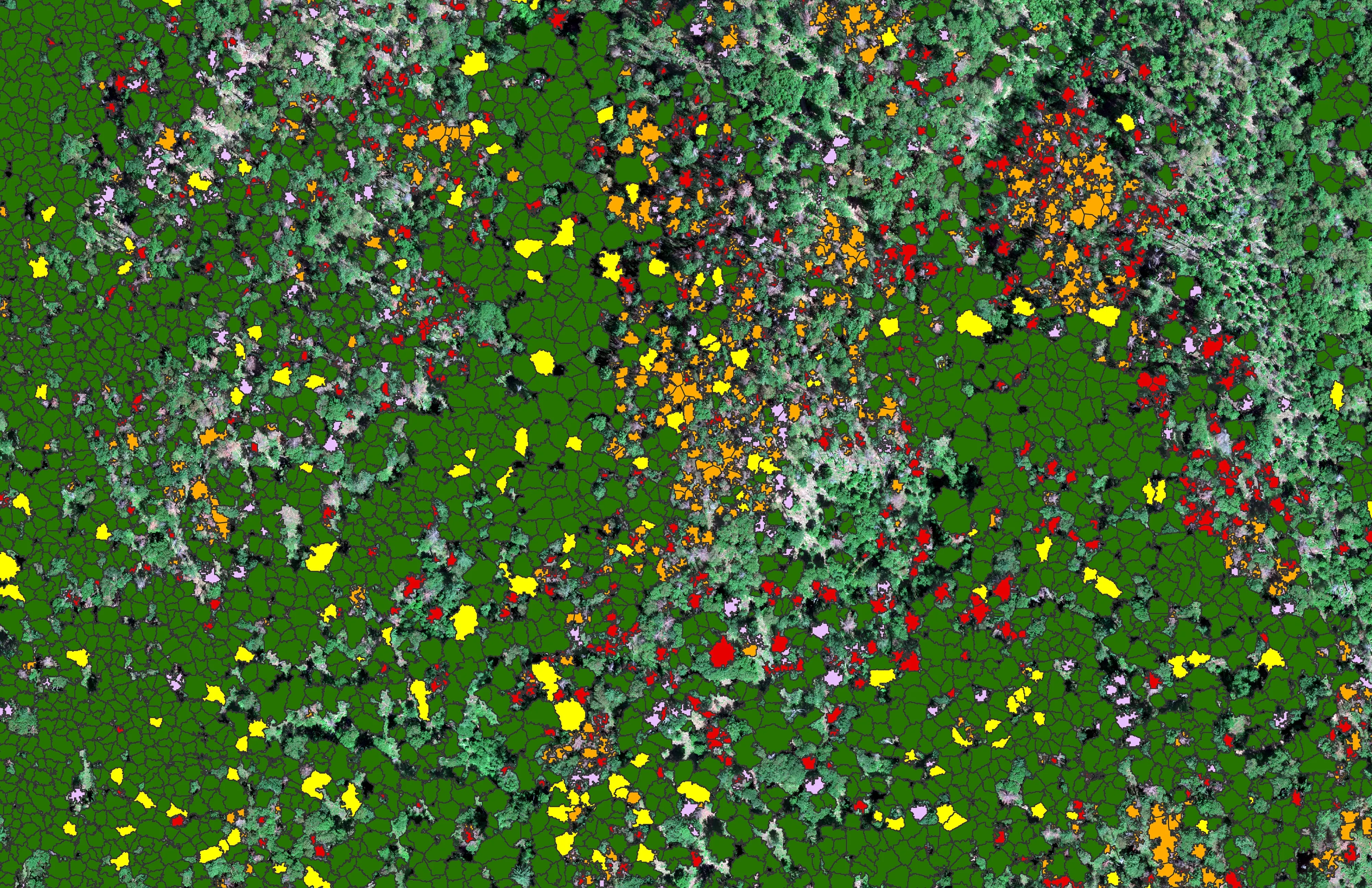
At risk, declining, dieback, dead
City of Ashland
About 30,000 Douglas fir crowns classed by health across the city's watershed lands, so the city could see the die off and act on it.
Read the case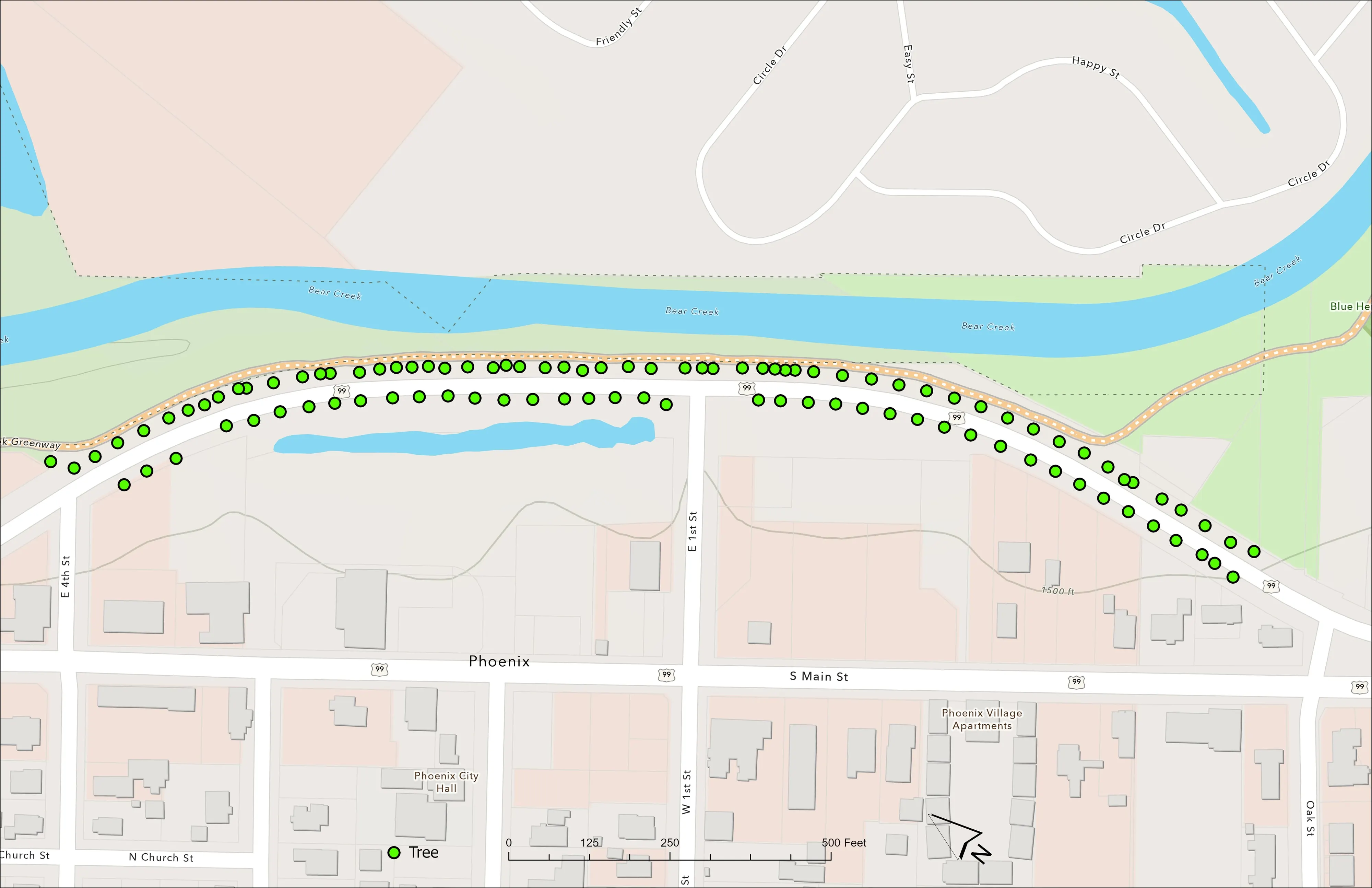
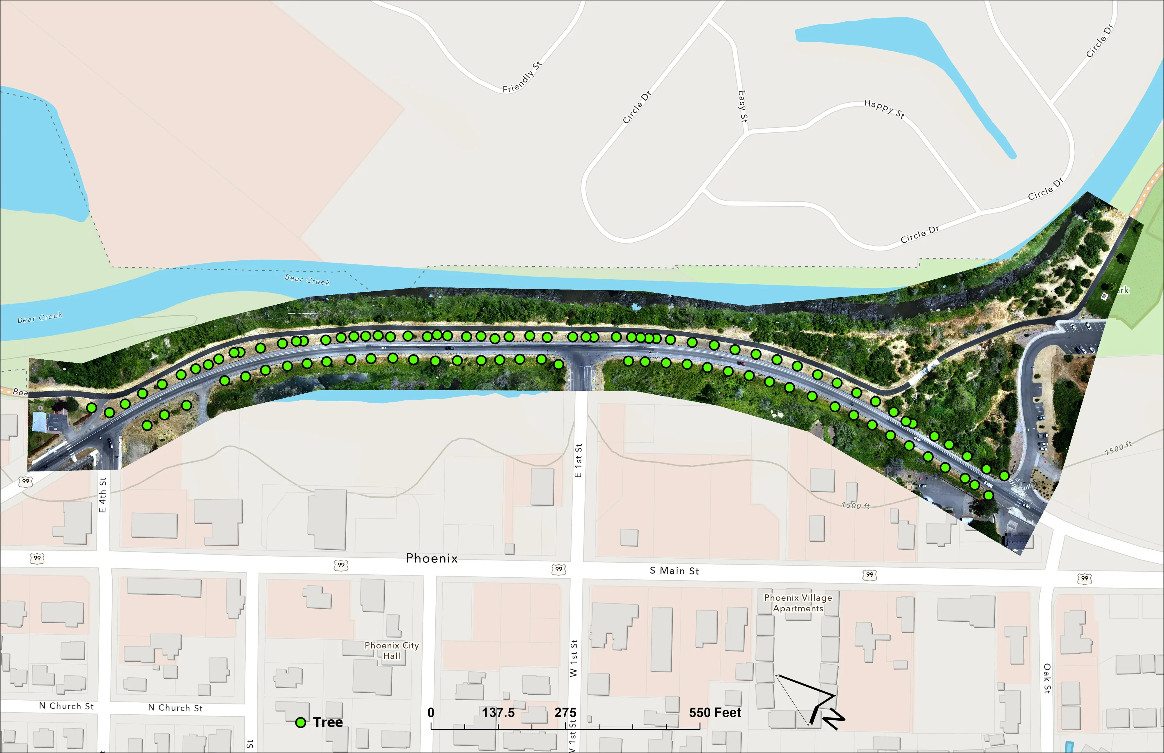
A planting corridor through Phoenix, tree by tree
City of Phoenix
The year one record for 98 trees the city planted where the Almeda fire burned through Phoenix, from drone LiDAR and RGB flown 65 days after planting.
Read the caseThe record
Every project we have published
Forestry and trees
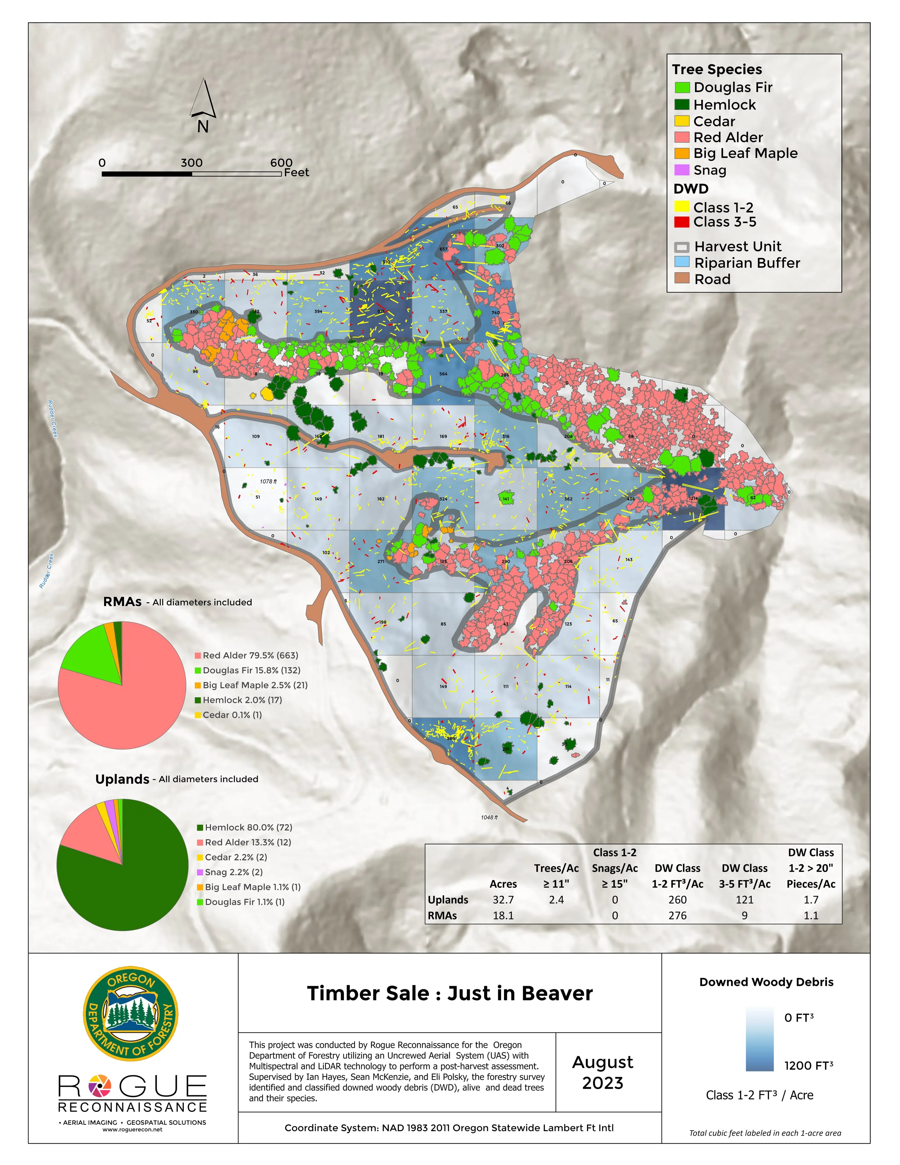
- Downed woody debris, measured from the air
- Finding every Oregon ash before the borer does
- At risk, declining, dieback, dead
- Post harvest monitoring for ODF
- A planting corridor through Phoenix, tree by tree
Rivers and habitat
- Riparian species and cold seeps on the Scott River
- Ten abandoned mines, bare earth under the chaparral
Wildfire fuels and planning
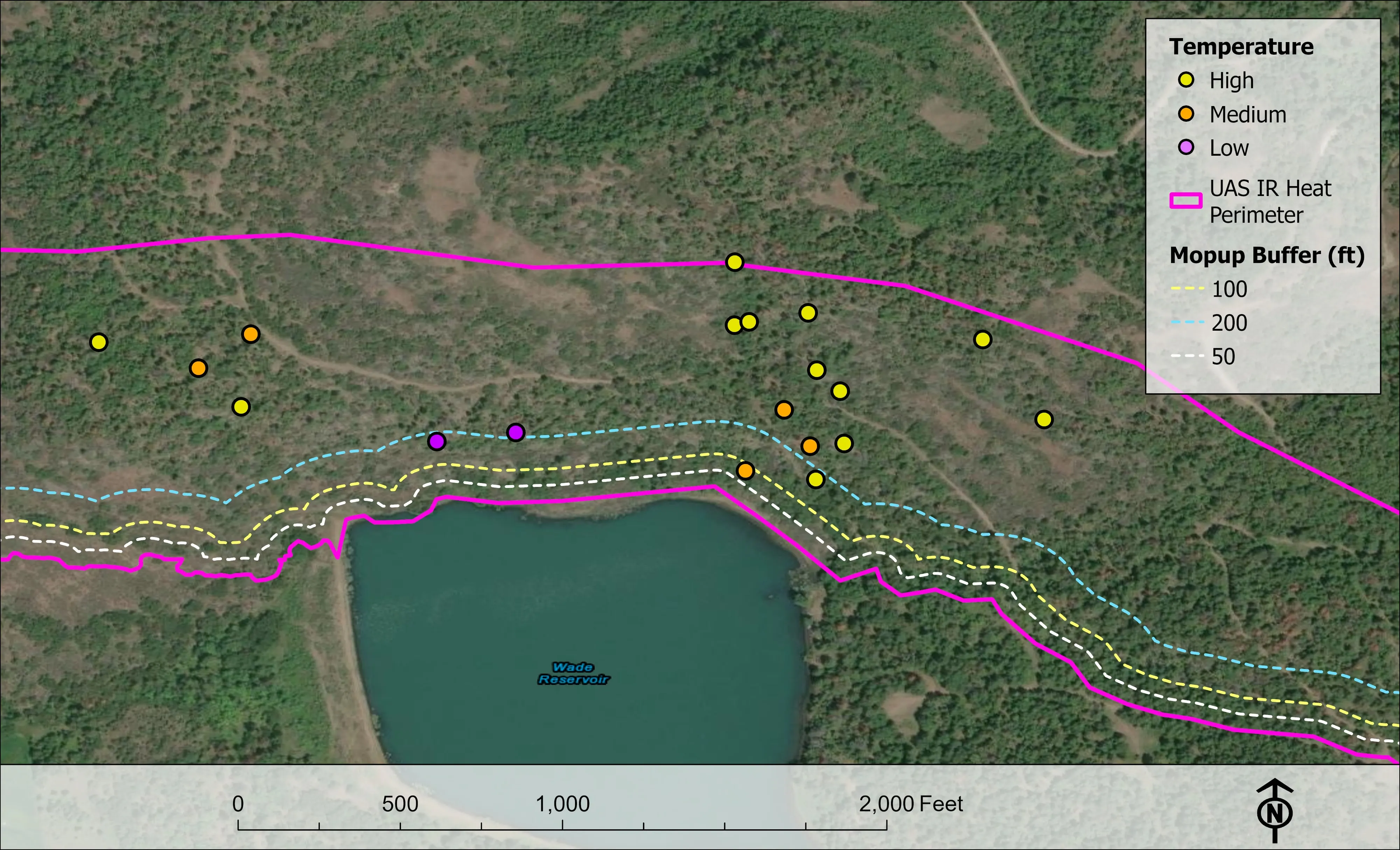
Night infrared on fires
- Night infrared on ODF incidents since 2019
- East Evans Creek, a season inside one fire
- Fielder Mountain, eleven nights as the heat went out
- Woodrat Mountain, from initial attack to the last check
- Interstate 5 at milepost 57, initial attack beside the freeway
- Tyee Ridge Complex
Terrain and site design
Farm planning
Ashland, the next flight.
The watershed again to measure the change, a park or a campus inventory, or the hillside neighbourhoods structure by structure. Tell us which and we will plan it.
Email info@roguerecon.net or call 808 298 6290.