

Albany, Oregon
Grass seed country, with the Cascades at the back door.
Albany is the middle of the valley: seed fields and mint flats on the river bottoms, mills and rail in town, and Linn County running east up the Santiam into timber that burned hard in 2020. Farm planning, terrain and canopy are the flights that fit here.
The ground
Albany and Linn County
The Willamette and the Calapooia meet at Albany, and the ground around town is the flattest, most farmed stretch of the valley: grass seed, mint, hazelnuts, grain, with drainage the first question on every field. East of Lebanon and Sweet Home the county climbs into the Cascades along the Santiam, through timber and reservoirs, to the ground the Beachie Creek and Lionshead fires crossed in 2020.
Who buys mapping here
- City of Albany: Parks and Recreation, Public Works, the GIS and planning groups; Lebanon and Sweet Home up the valley
- Linn County: Road Department, Parks, Emergency Management, Planning
- Albany Fire Department and the rural fire districts toward the Cascades
- Linn Soil and Water Conservation District, Calapooia Watershed Council, South Santiam Watershed Council
- Pacific Power and Consumers Power
- The Willamette National Forest and the BLM lands up the Santiam
- Seed growers, mint and hazelnut operations, and the engineers building on the river terraces
Getting there
From Medford
About three and a quarter hours from Medford on Interstate 5. Flown on the same trip as Corvallis and Salem.
The public lidar
What exists, and what it misses
Linn County has state consortium lidar over the valley floor and much of the foothills, good for the big drainage picture and for floodplain mapping. A farm plan wants the low points and flow paths at the resolution of a single field after a wet winter, and a canopy or post fire question wants this year's trees, which is what a drone flight adds.
What we would fly
The lanes that fit Albany
Nearest work
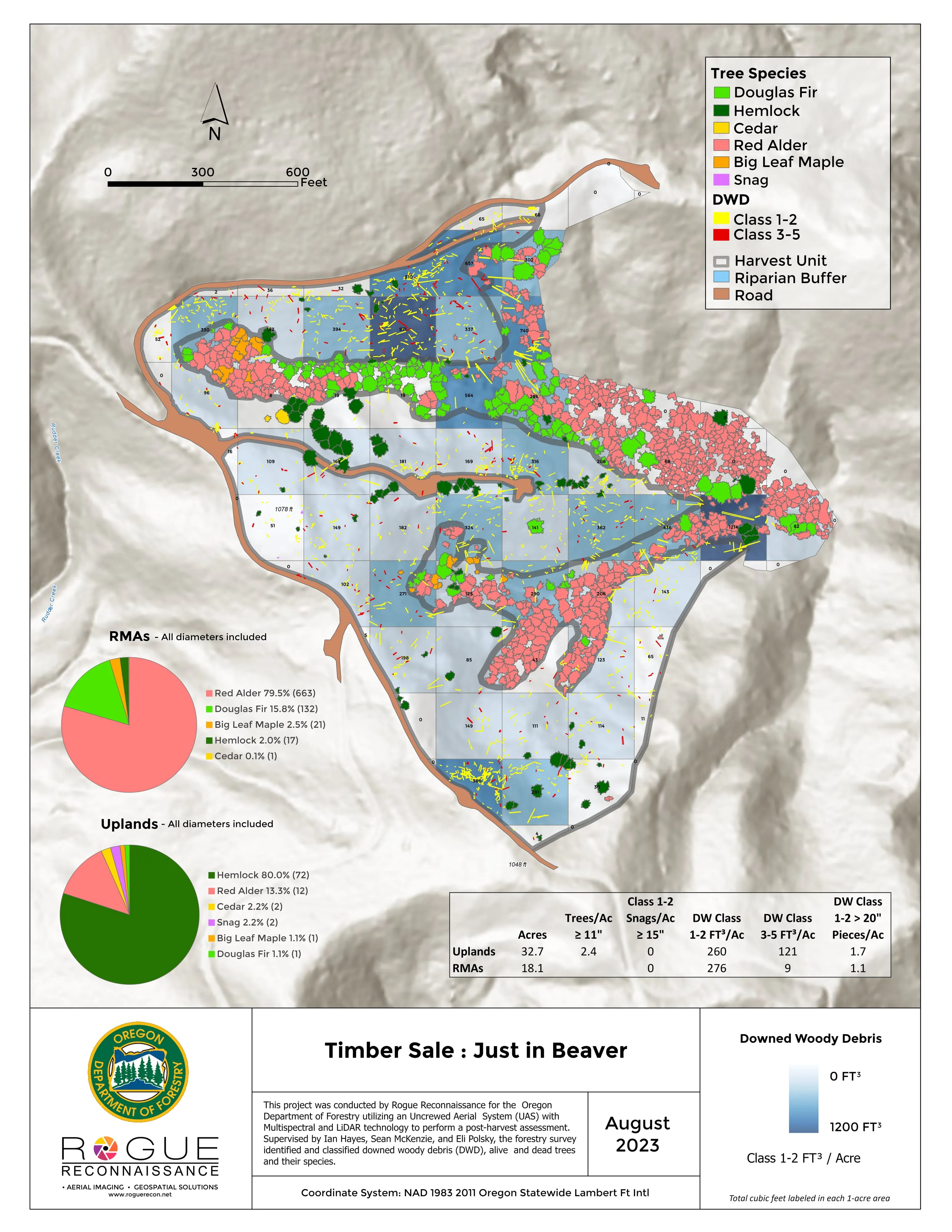
Linn County has no published case yet; the proof nearest to it is the Talent nursery plan, the Eugene inventory an hour south, and a post harvest unit measured for ODF.
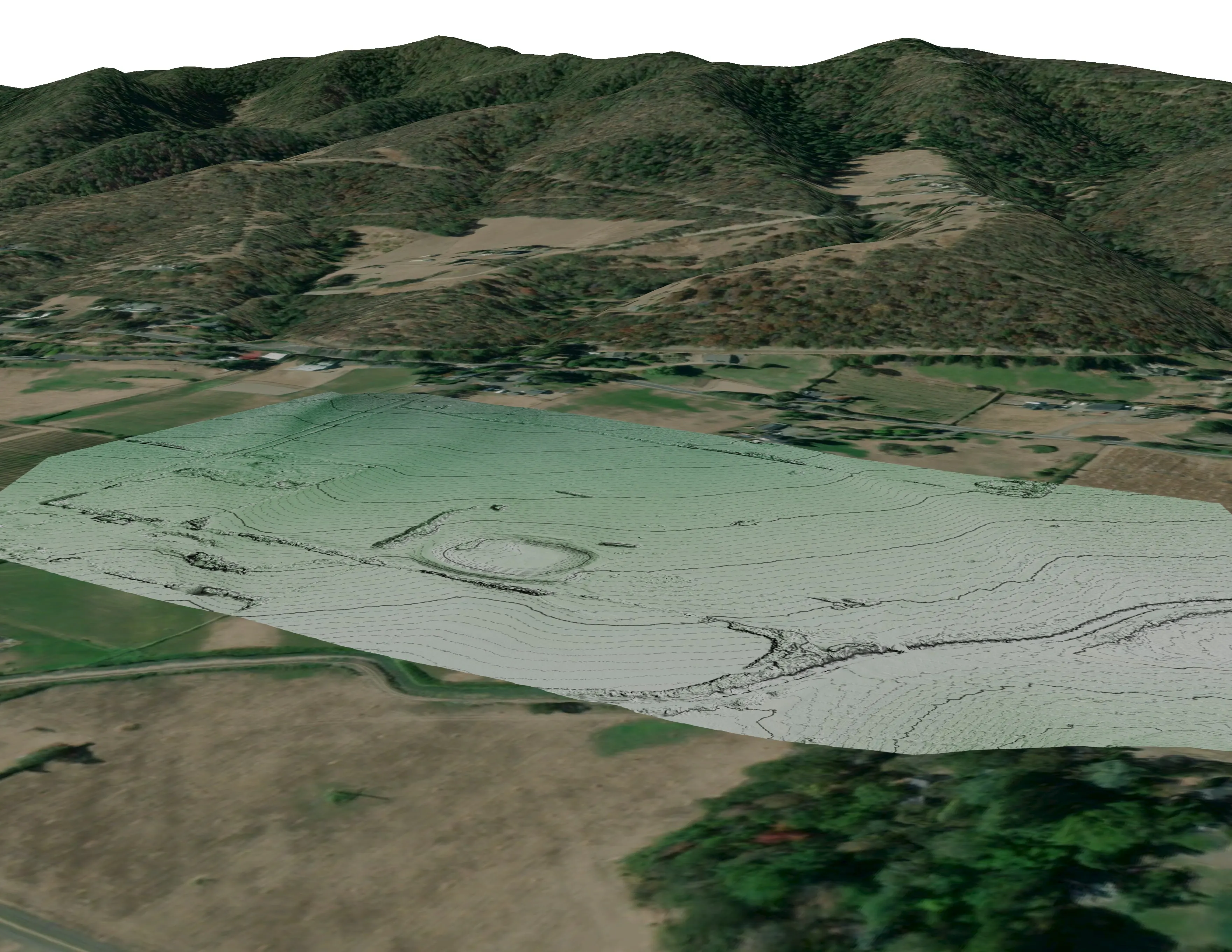
A farm plan on real ground
Plant Oregon with Oregon Urban Rural and Community Forestry, a tree nursery in development
Terrain, ponds, tree mounds, and a site plan drawn on a current ortho of the whole farm.
Read the case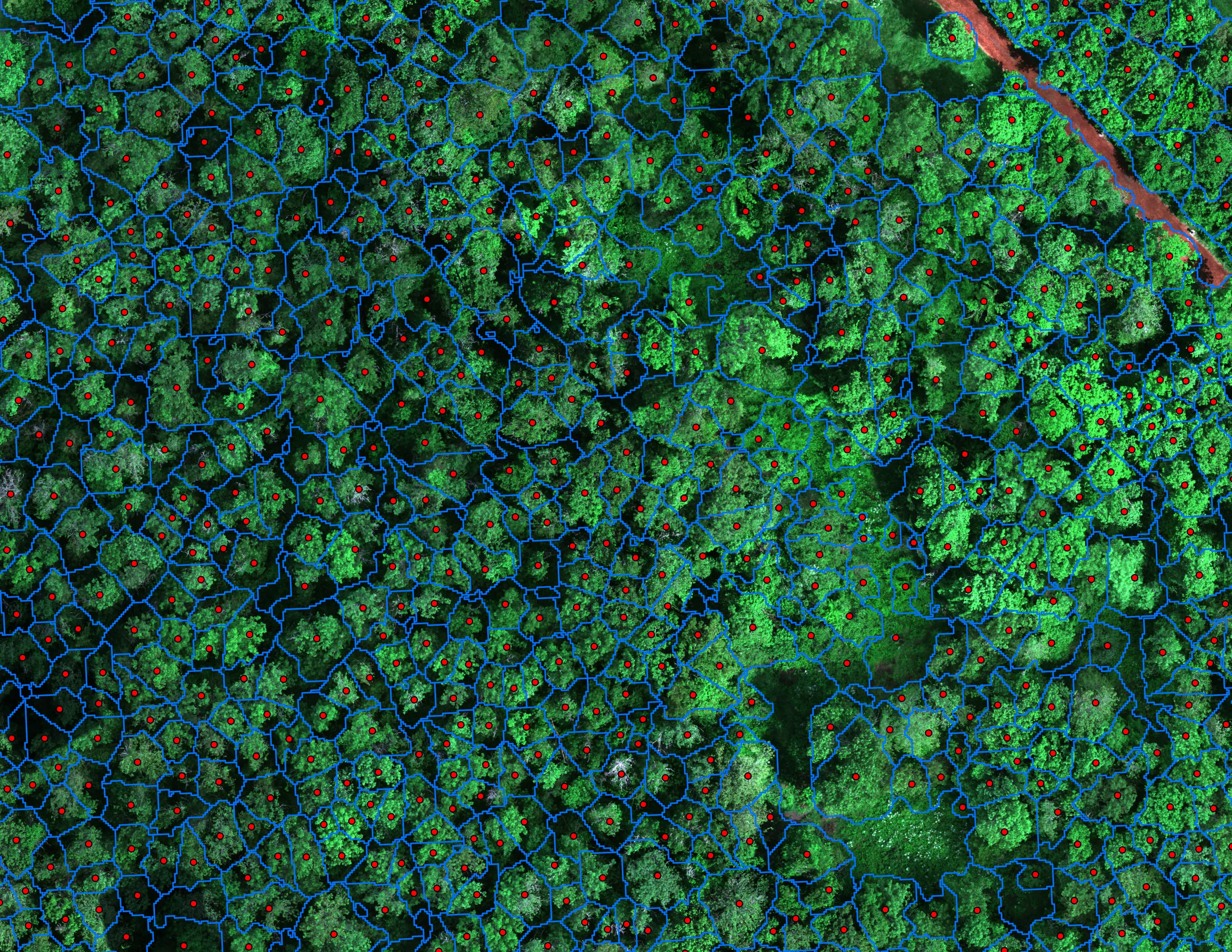
Finding every Oregon ash before the borer does
City of Eugene, Parks and Open Space
12,632 crowns classified across 390 acres of riparian canopy. 5,261 of them Oregon ash.
Read the case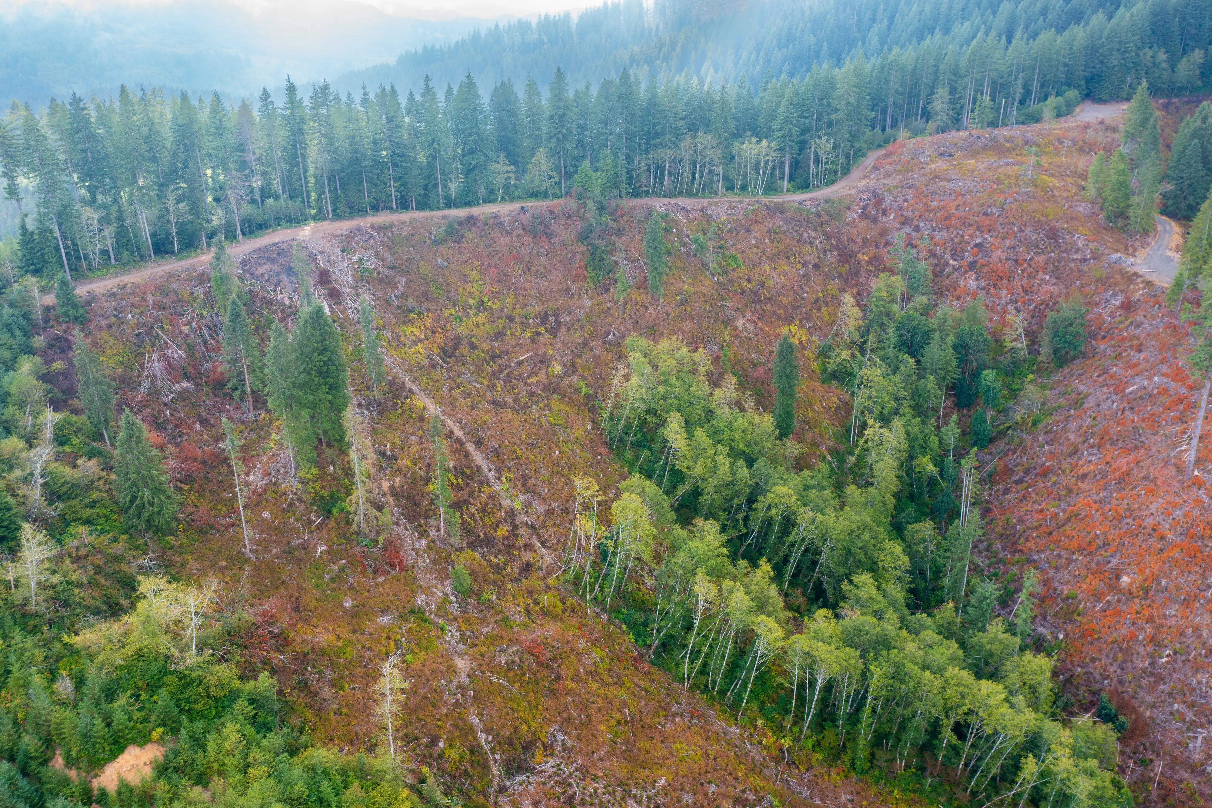
Post harvest monitoring for ODF
Oregon Department of Forestry
The 2023 ODF unit on video and in a StoryMap, with how the LiDAR, multispectral, and RGB products were built.
Read the caseThe record
Every project we have published
Forestry and trees
- Downed woody debris, measured from the air
- Finding every Oregon ash before the borer does
- At risk, declining, dieback, dead
- Post harvest monitoring for ODF
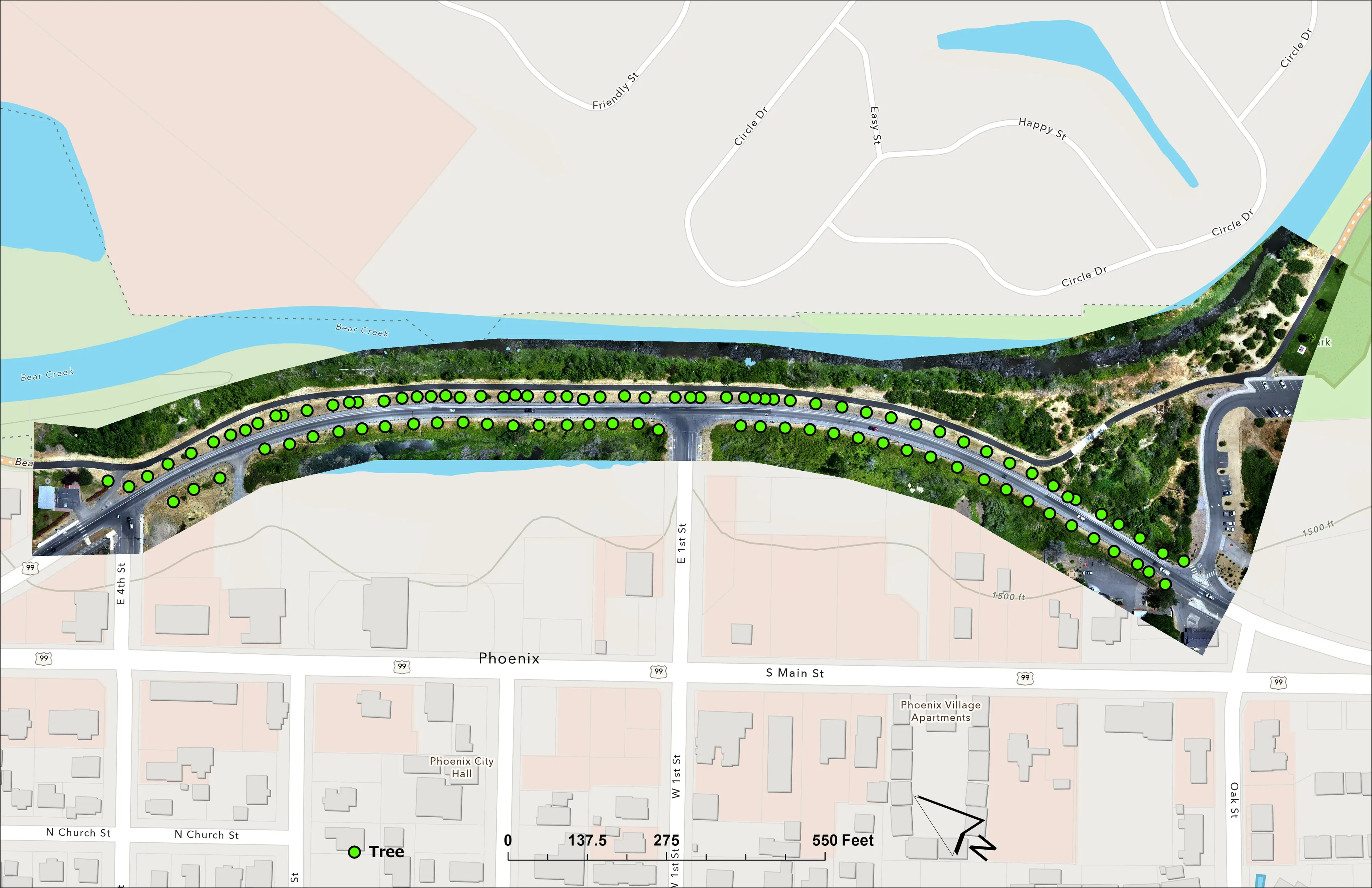
- A planting corridor through Phoenix, tree by tree
Rivers and habitat
- Riparian species and cold seeps on the Scott River
- Ten abandoned mines, bare earth under the chaparral
Wildfire fuels and planning
Night infrared on fires
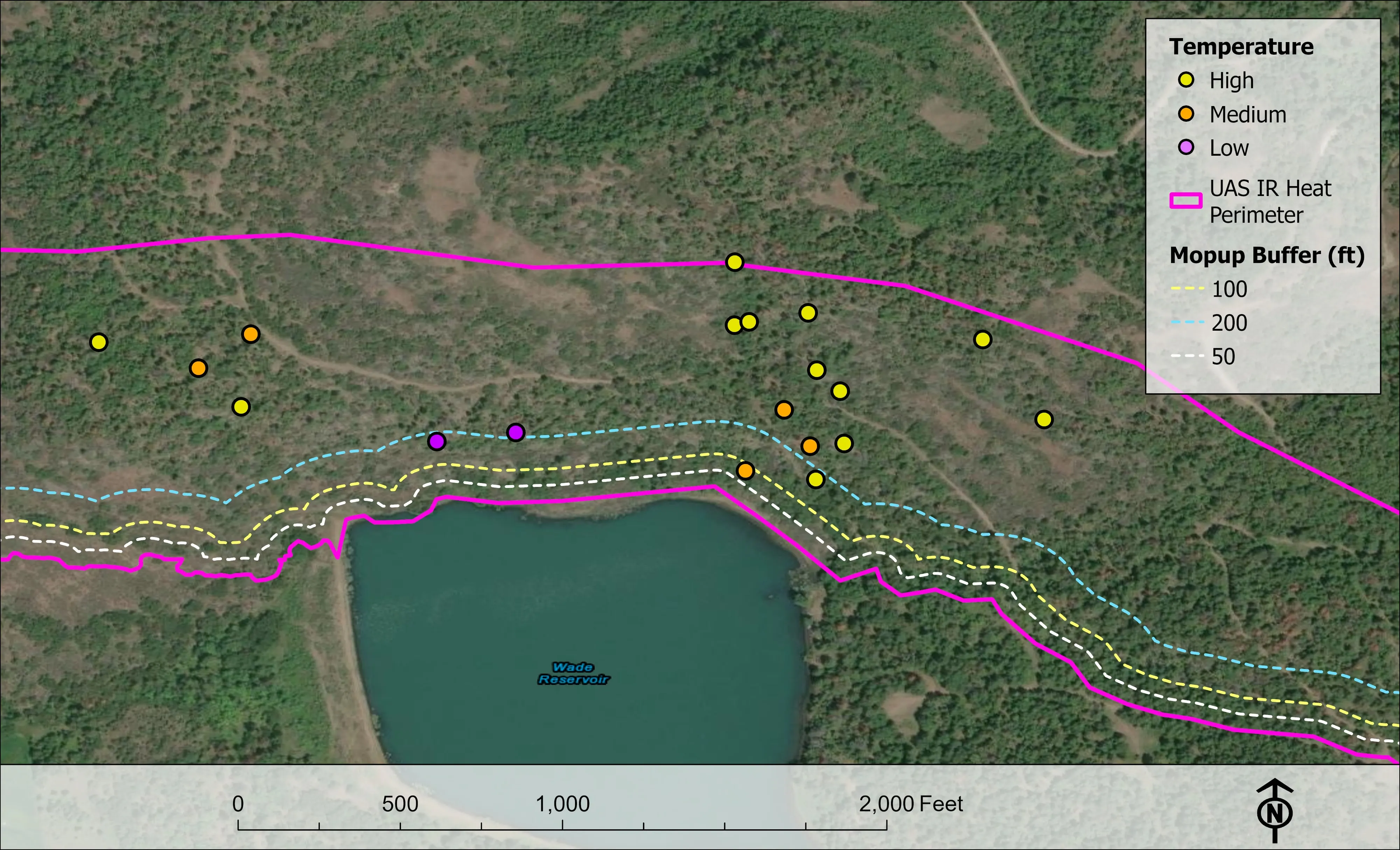
- Night infrared on ODF incidents since 2019
- East Evans Creek, a season inside one fire
- Fielder Mountain, eleven nights as the heat went out
- Woodrat Mountain, from initial attack to the last check
- Interstate 5 at milepost 57, initial attack beside the freeway
- Tyee Ridge Complex
Terrain and site design
Farm planning
Albany and Linn County, field by field.
A drainage question on a seed field, a stand up the Santiam, or a site in town. Send the ground and we will plan it into the next valley trip.
Email info@roguerecon.net or call 808 298 6290.