

Modesto, California
Almond country on the Tuolumne, with the biggest floodplain restoration in the state.
Stanislaus County is almonds, walnuts and dairies from the Coast Range to the Sierra foothills, run on two irrigation districts that also sell the power, and the Tuolumne River through Modesto is where California's largest floodplain restoration is being planted. Orchard planning and restoration baselines are the flights that fit.
The ground
Modesto and Stanislaus County
Modesto sits on the Tuolumne where it crosses the valley floor to meet the San Joaquin west of town, with the Stanislaus River to the north and the Merced to the south, all three coming off the Sierra through reservoirs the districts own. The county is orchards nearly wall to wall, dairies between them, and the Dos Rios ranch at the rivers' meeting is being turned back into floodplain forest at a scale nowhere else in the state has tried. The foothills to the east are oak and range toward the Stanislaus National Forest.
Who buys mapping here
- City of Modesto: Parks, Recreation and Neighborhoods and the urban forestry program, Public Works, Utilities, the GIS group; Turlock, Ceres, Oakdale, Riverbank
- Stanislaus County: Public Works, Parks and Recreation, the Office of Emergency Services, the Agricultural Commissioner
- Modesto Irrigation District and Turlock Irrigation District, with their canals, reservoirs and power lines
- The Tuolumne River Trust, River Partners and the Dos Rios restoration partners
- The East Stanislaus Resource Conservation District and the groundwater sustainability agencies of the subbasin
- California State University, Stanislaus and Modesto Junior College's agricultural programs
- The Stanislaus National Forest and the foothill fire safe councils
- Almond, walnut and dairy operations across the county, and the processors with land to manage
Getting there
From Medford
Six and a half hours south on Interstate 5 and Highway 99; Modesto pairs with Stockton on the northern valley trip.
The public lidar
What exists, and what it misses
The county and the state have flown the rivers and the valley floor for flood and groundwater work. An orchard block's replant plan, a dairy's drainage, a restoration planting counted tree by tree in its first years or a river reach after a flood each need a current flight at the field or the reach, which the valley surface cannot give.
What we would fly
The lanes that fit Modesto
Nearest work
Stanislaus County is still ahead of us. What fits it from Oregon: a planting corridor counted at year one, the Talent nursery plan, and a river reach mapped species by species.
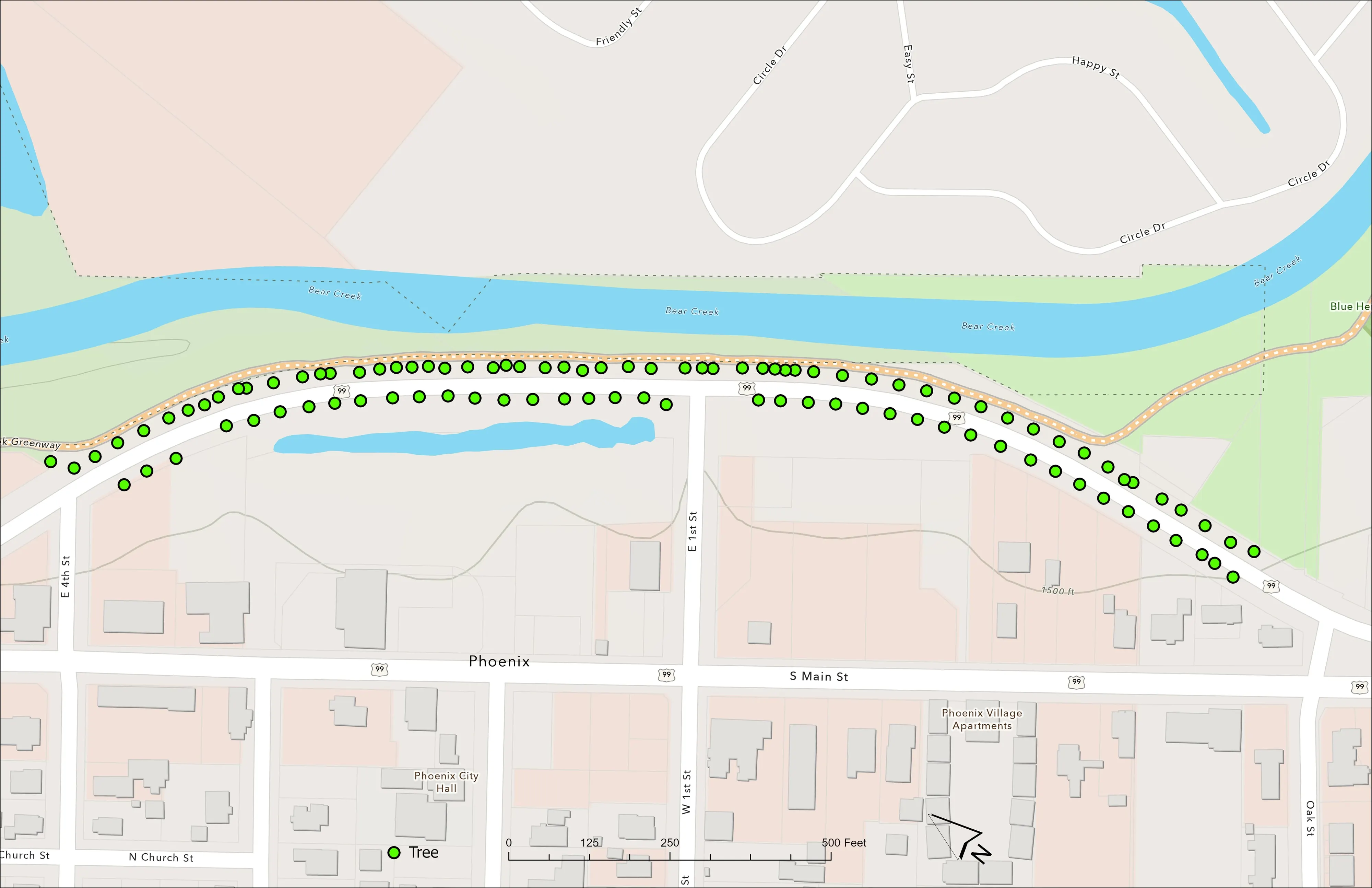
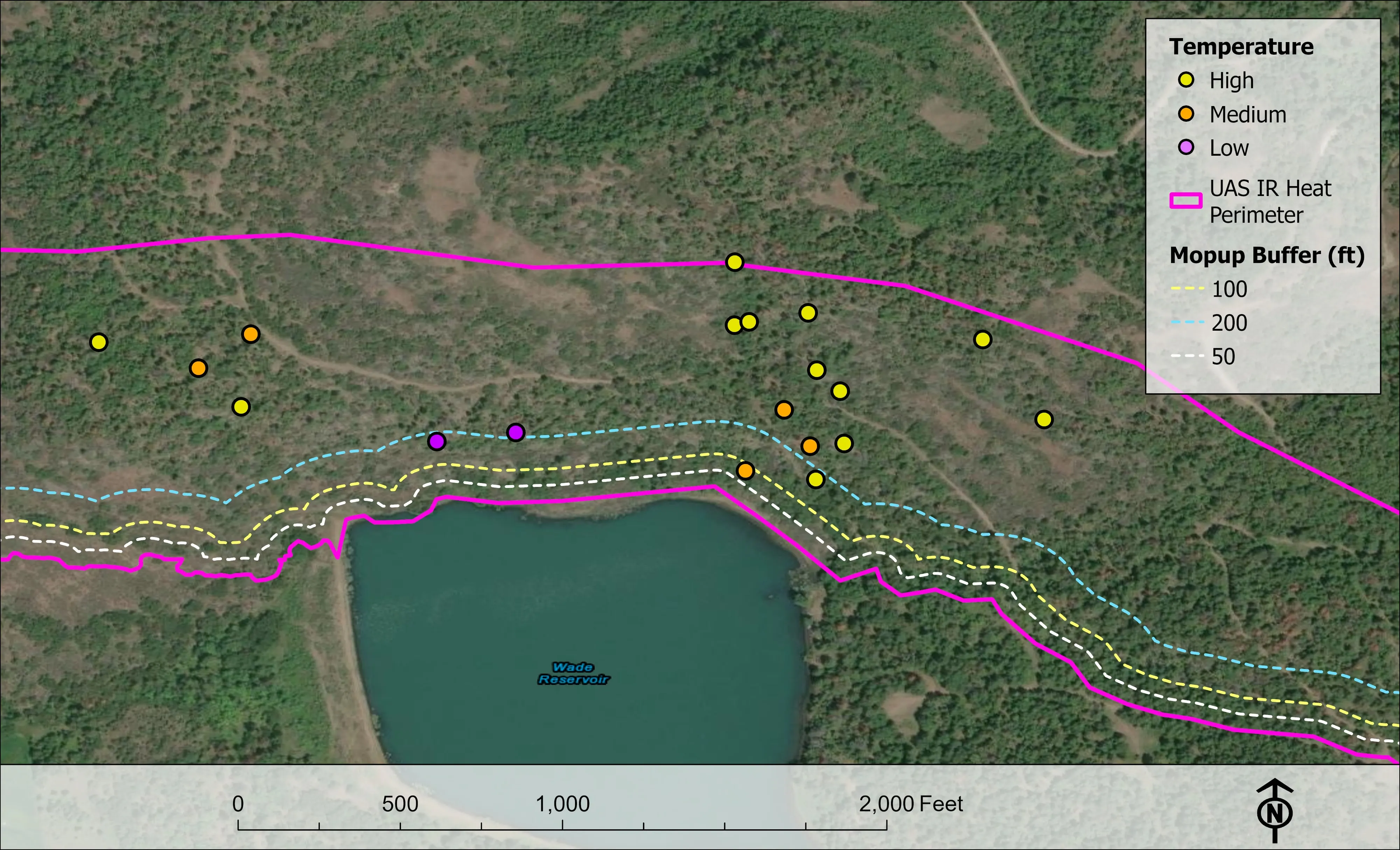
A planting corridor through Phoenix, tree by tree
City of Phoenix
The year one record for 98 trees the city planted where the Almeda fire burned through Phoenix, from drone LiDAR and RGB flown 65 days after planting.
Read the case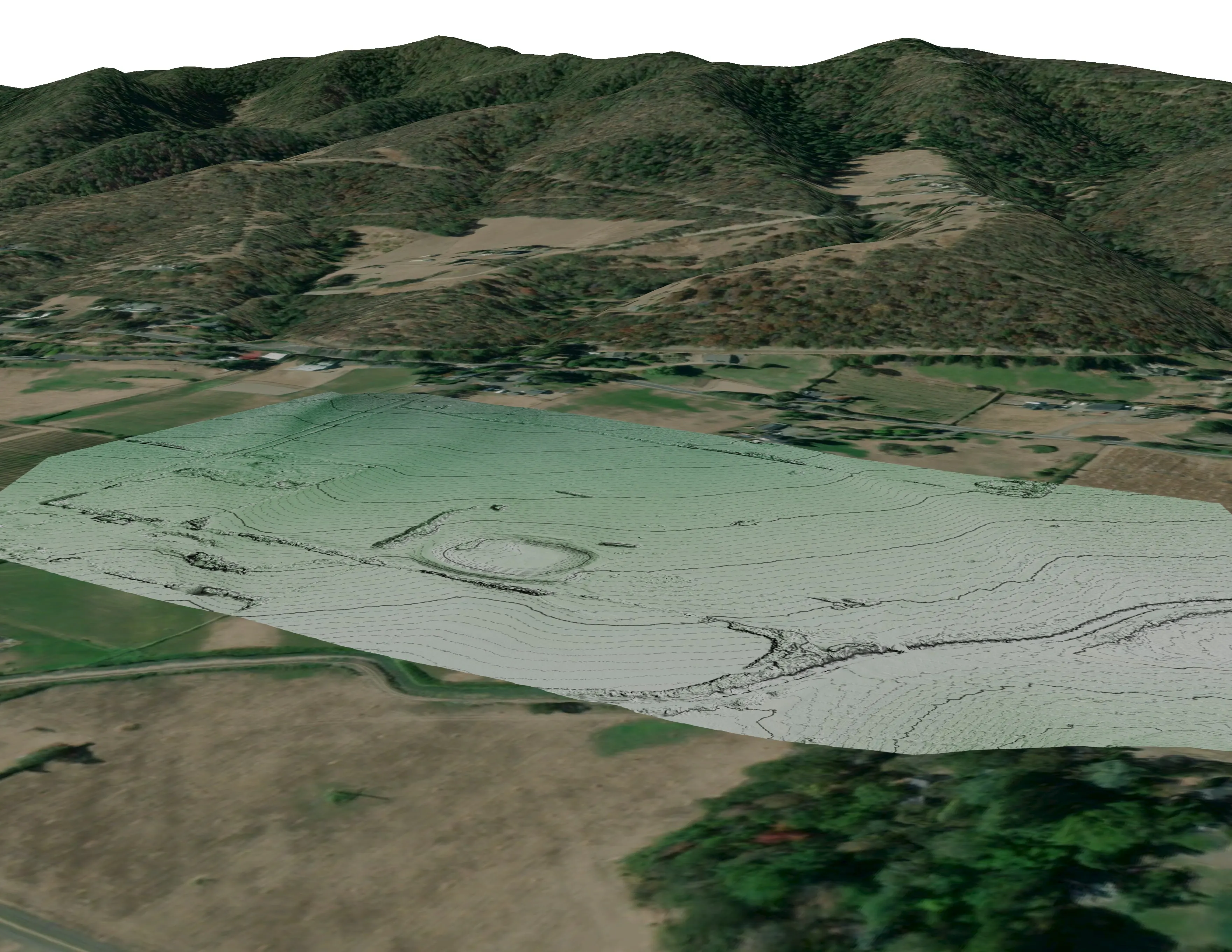
A farm plan on real ground
Plant Oregon with Oregon Urban Rural and Community Forestry, a tree nursery in development
Terrain, ponds, tree mounds, and a site plan drawn on a current ortho of the whole farm.
Read the case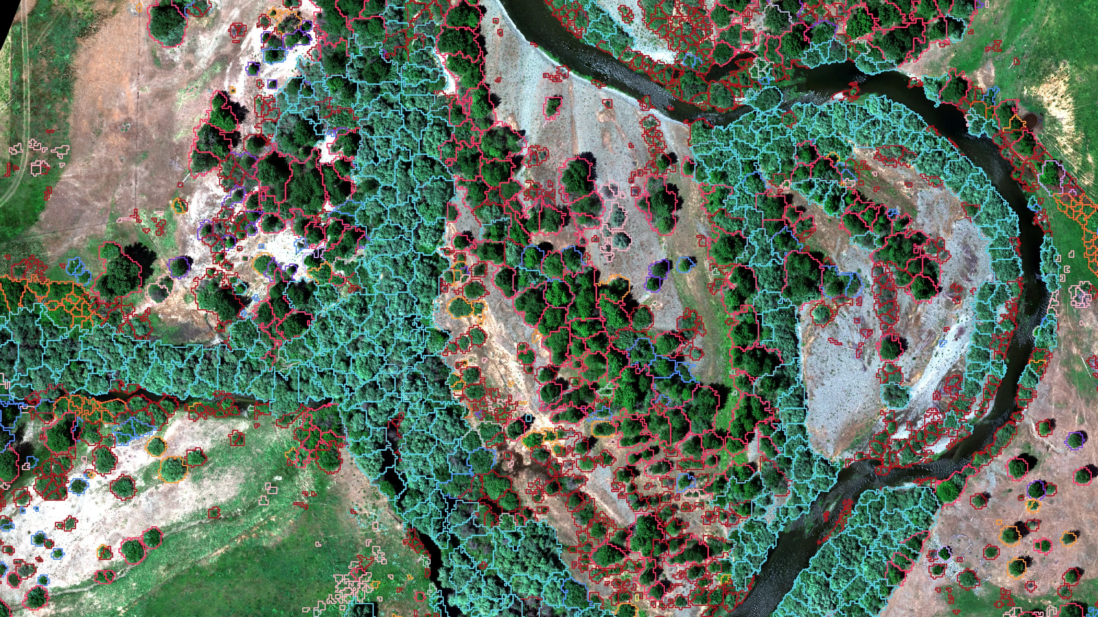
Riparian species and cold seeps on the Scott River
Cascade Stream Solutions, with a botanist leading field identification. We flew it as their subcontractor and reported to them.
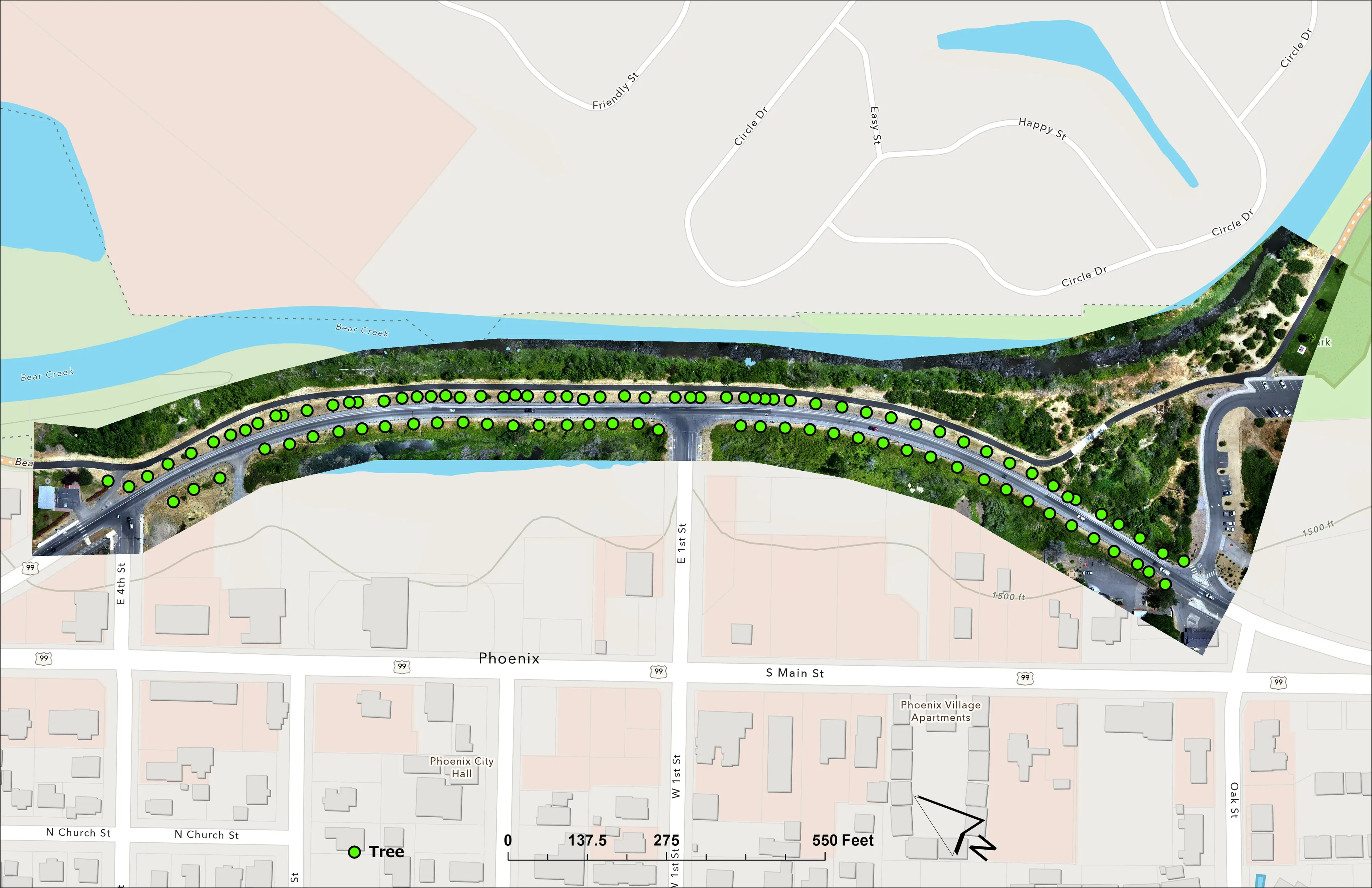
Fourteen riparian species classified across 423 acres of river corridor, with thermal mapping that pointed to groundwater fed cold seeps.
Read the caseThe record
Every project we have published
Forestry and trees
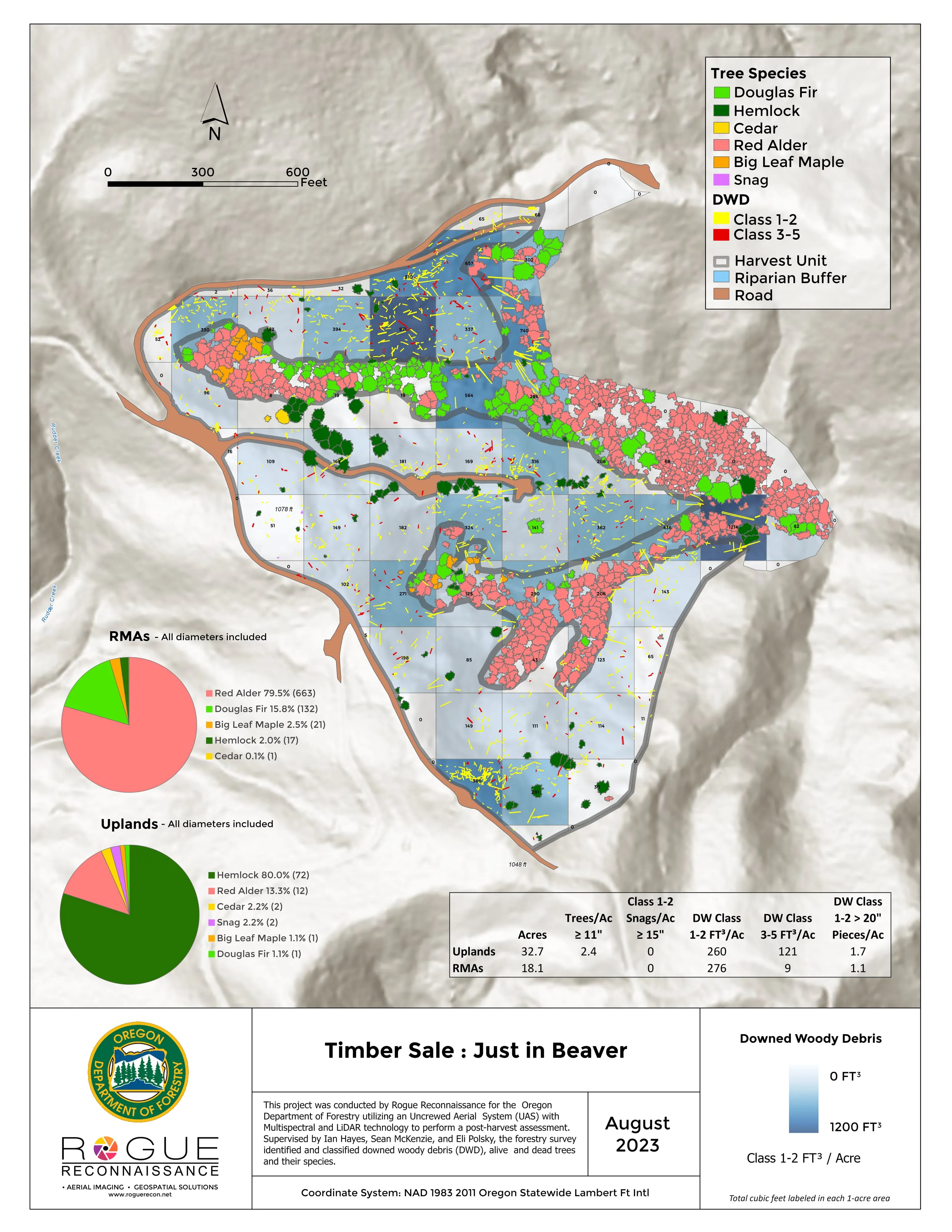
- Downed woody debris, measured from the air
- Finding every Oregon ash before the borer does
- At risk, declining, dieback, dead
- Post harvest monitoring for ODF
- A planting corridor through Phoenix, tree by tree
Rivers and habitat
- Riparian species and cold seeps on the Scott River
- Ten abandoned mines, bare earth under the chaparral
Wildfire fuels and planning
Night infrared on fires
- Night infrared on ODF incidents since 2019
- East Evans Creek, a season inside one fire
- Fielder Mountain, eleven nights as the heat went out
- Woodrat Mountain, from initial attack to the last check
- Interstate 5 at milepost 57, initial attack beside the freeway
- Tyee Ridge Complex
Terrain and site design
Farm planning
Modesto and the Tuolumne.
An orchard block, a dairy, a restoration reach or a city canopy count. Tell us the ground and the season and Modesto rides with Stockton on the trip.
Email info@roguerecon.net or call 808 298 6290.