

Fresno, California
The richest farm county in the country, with the Sierra at its back.
Fresno County grows more by value than almost any county in America, and the city in the middle of it has a river parkway to restore, a canopy it is trying to grow in brutal summers, and the Sierra National Forest an hour east where the Creek fire burned in 2020. Orchard planning, canopy and post fire mapping are the flights that fit.
The ground
Fresno and Fresno County and Madera County
Fresno and Clovis sit on the valley floor between the San Joaquin River on the north and the Kings on the south, with almonds, grapes, citrus, stone fruit and dairies in every direction and canals carrying Sierra water through all of it. East the land climbs through oak foothills to the Sierra National Forest, Shaver and Huntington lakes and the Creek fire footprint, then to Kings Canyon and Yosemite. The city's own tree canopy is thin and the summers are the reason.
Who buys mapping here
- City of Fresno: Parks, After School, Recreation and Community Services, Public Works, the Urban Forestry program, the GIS group; City of Clovis
- Fresno County and Madera County: Public Works and Planning, Emergency Services
- The San Joaquin River Parkway and Conservation Trust and the San Joaquin River Conservancy
- Fresno Irrigation District, the Kings River Conservation District and the groundwater agencies of the subbasin
- Fresno Metropolitan Flood Control District
- Tree Fresno and the canopy programs; California State University, Fresno and its farm
- The Sierra National Forest, CAL FIRE's Fresno Kings Unit, and the foothill fire safe councils
- Pacific Gas and Electric; the almond, grape, citrus and dairy operations of the county
Getting there
From Medford
About eight hours from Medford down Interstate 5 and across on 99, or a flight into Fresno Yosemite International. The valley is a trip of its own, Fresno to Bakersfield.
The public lidar
What exists, and what it misses
The valley has federal lidar flown for flood and groundwater work and the foothills were flown after the fire. An orchard block's drainage, a vineyard's slope, a parkway restoration reach or a city's street tree inventory want a current flight at their own resolution, not the valley wide surface.
What we would fly
The lanes that fit Fresno
Nearest work
Fresno County has not seen the aircraft. The applicable Oregon work: a nursery planned on drone LiDAR terrain, a restoration corridor counted in year one, and a watershed of conifers classed by health.
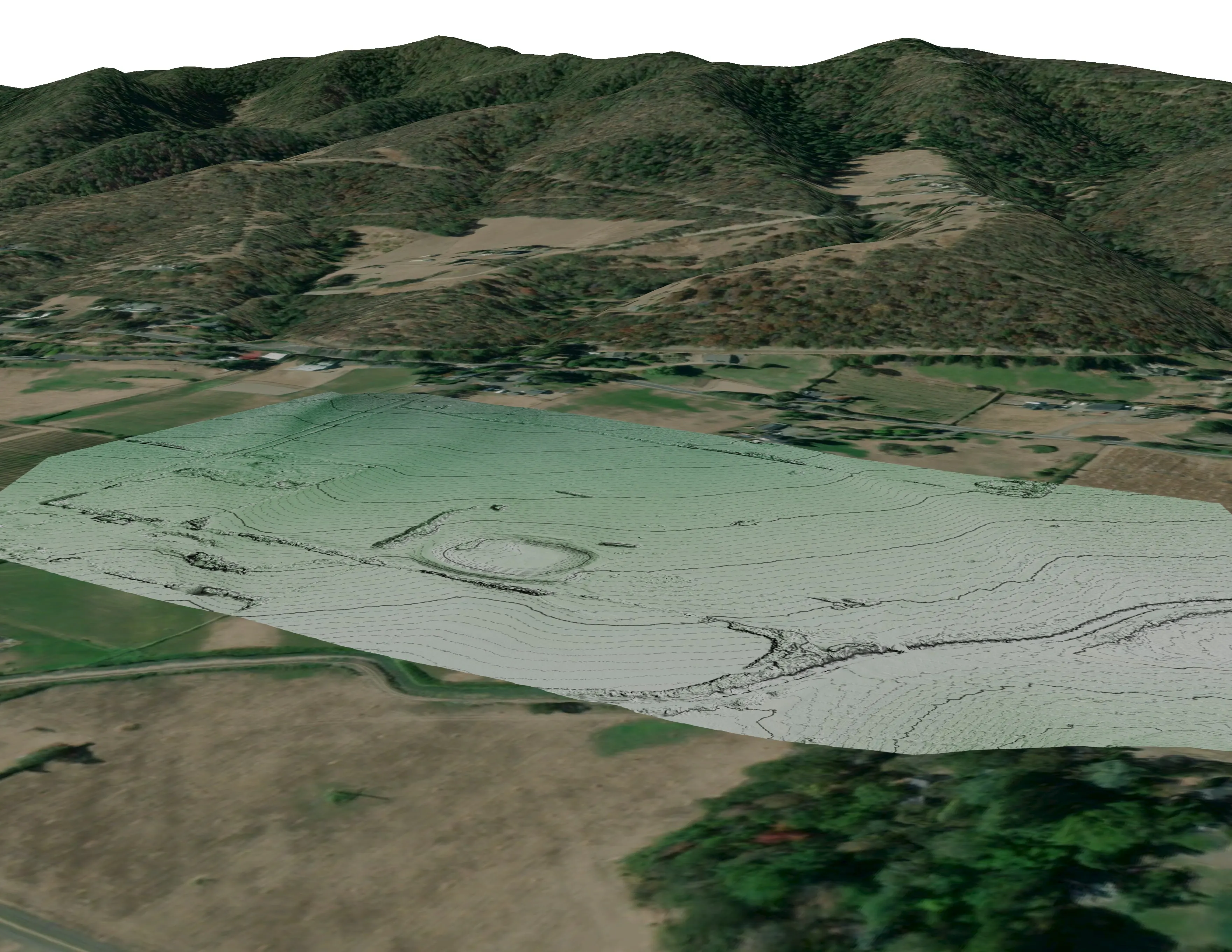
A farm plan on real ground
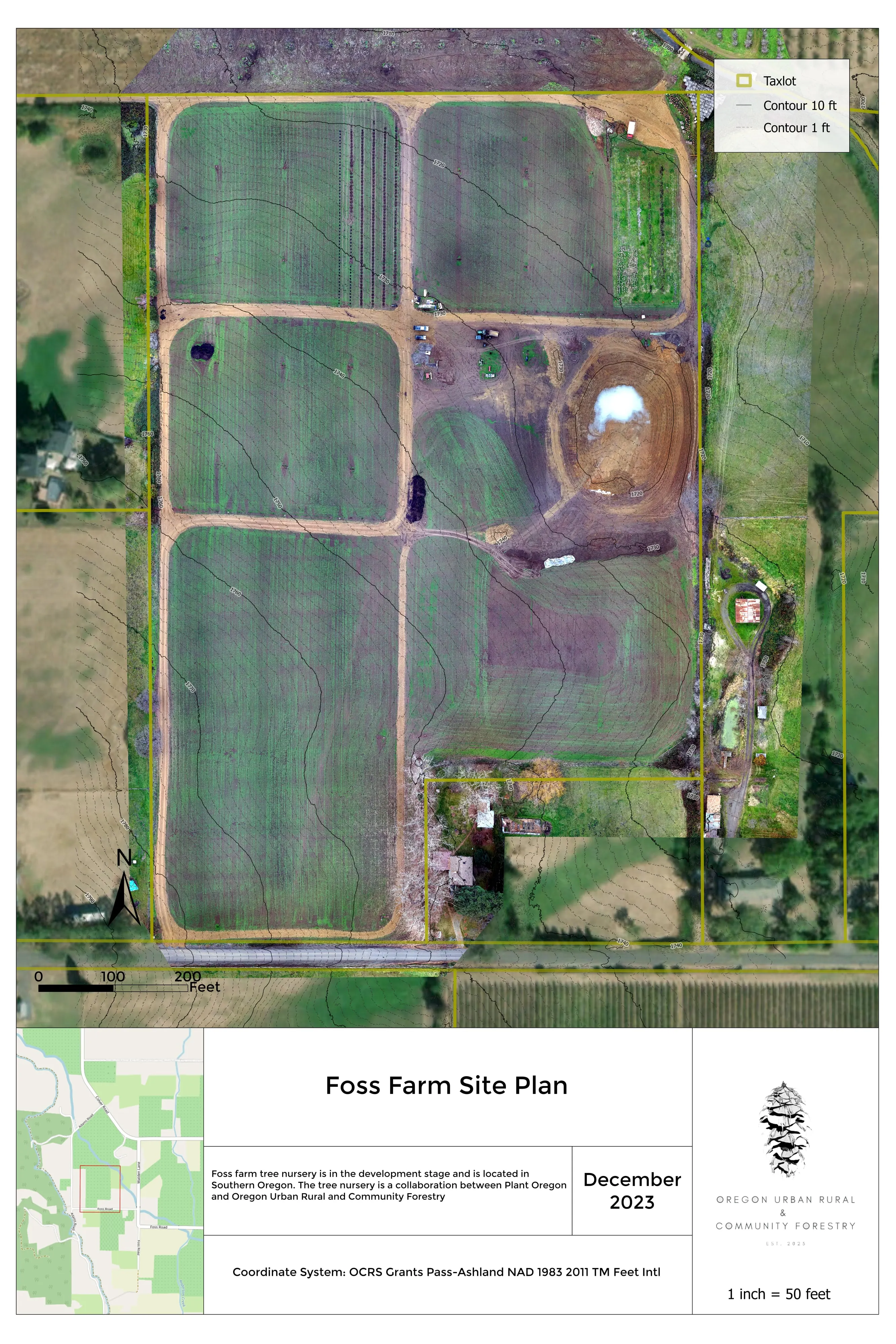
Plant Oregon with Oregon Urban Rural and Community Forestry, a tree nursery in development
Terrain, ponds, tree mounds, and a site plan drawn on a current ortho of the whole farm.
Read the case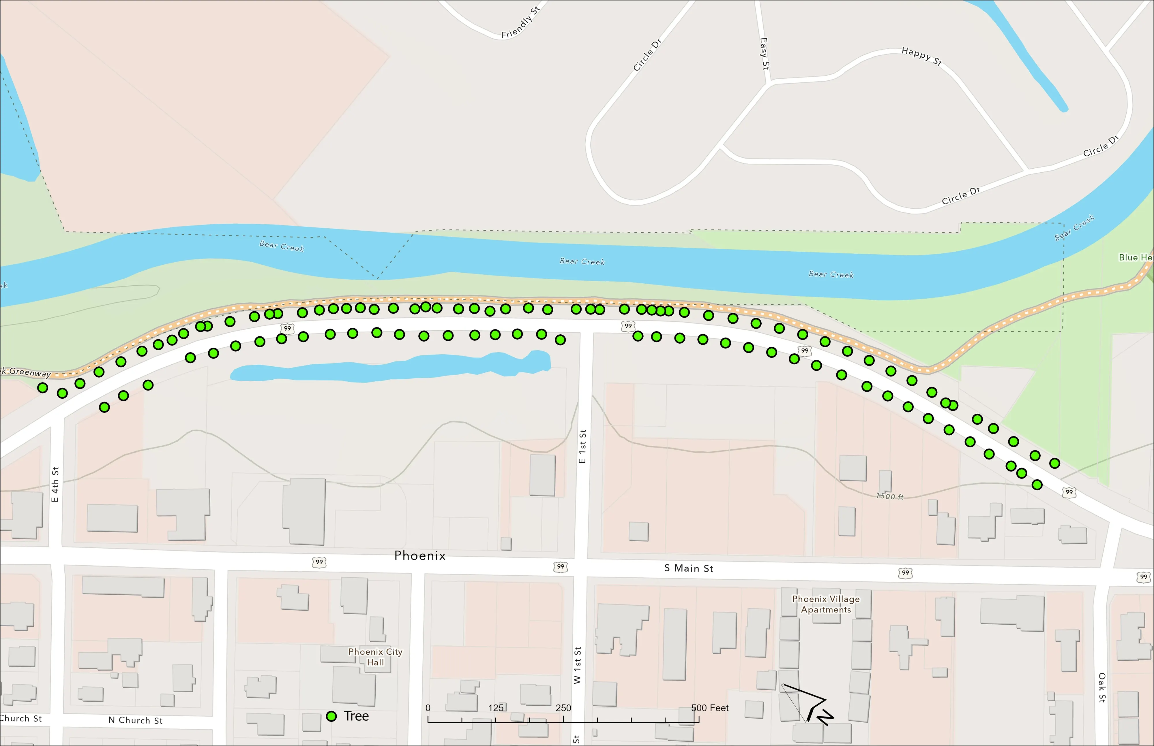
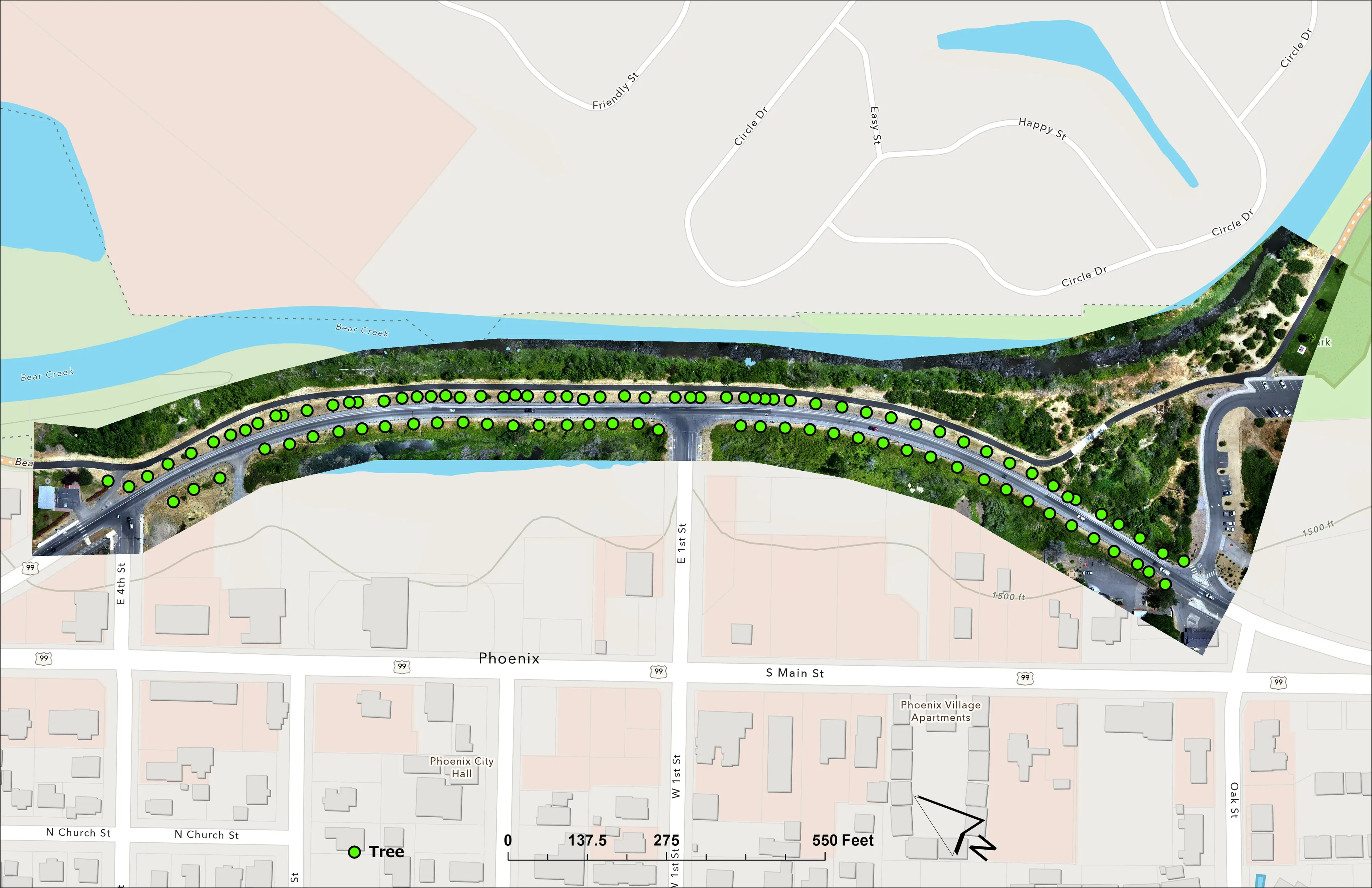
A planting corridor through Phoenix, tree by tree
City of Phoenix
The year one record for 98 trees the city planted where the Almeda fire burned through Phoenix, from drone LiDAR and RGB flown 65 days after planting.
Read the case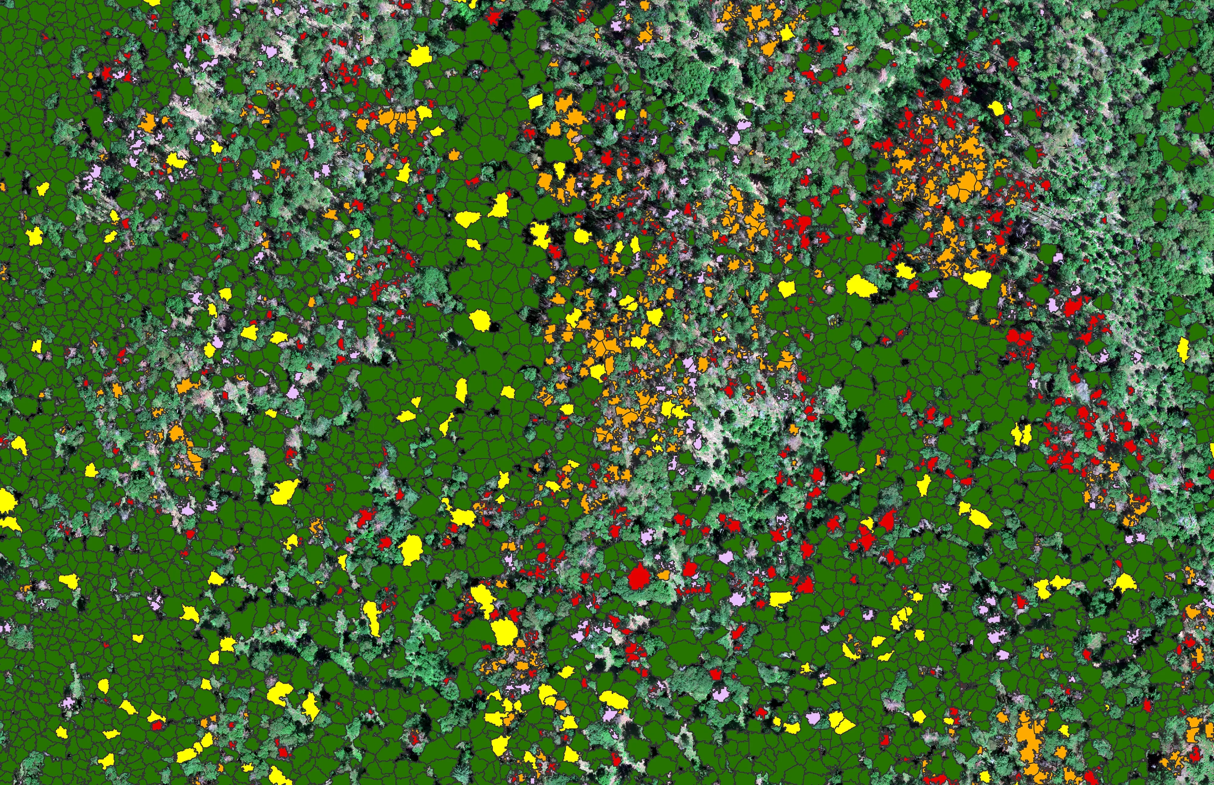
At risk, declining, dieback, dead
City of Ashland
About 30,000 Douglas fir crowns classed by health across the city's watershed lands, so the city could see the die off and act on it.
Read the caseThe record
Every project we have published
Forestry and trees
- Downed woody debris, measured from the air
- Finding every Oregon ash before the borer does
- At risk, declining, dieback, dead
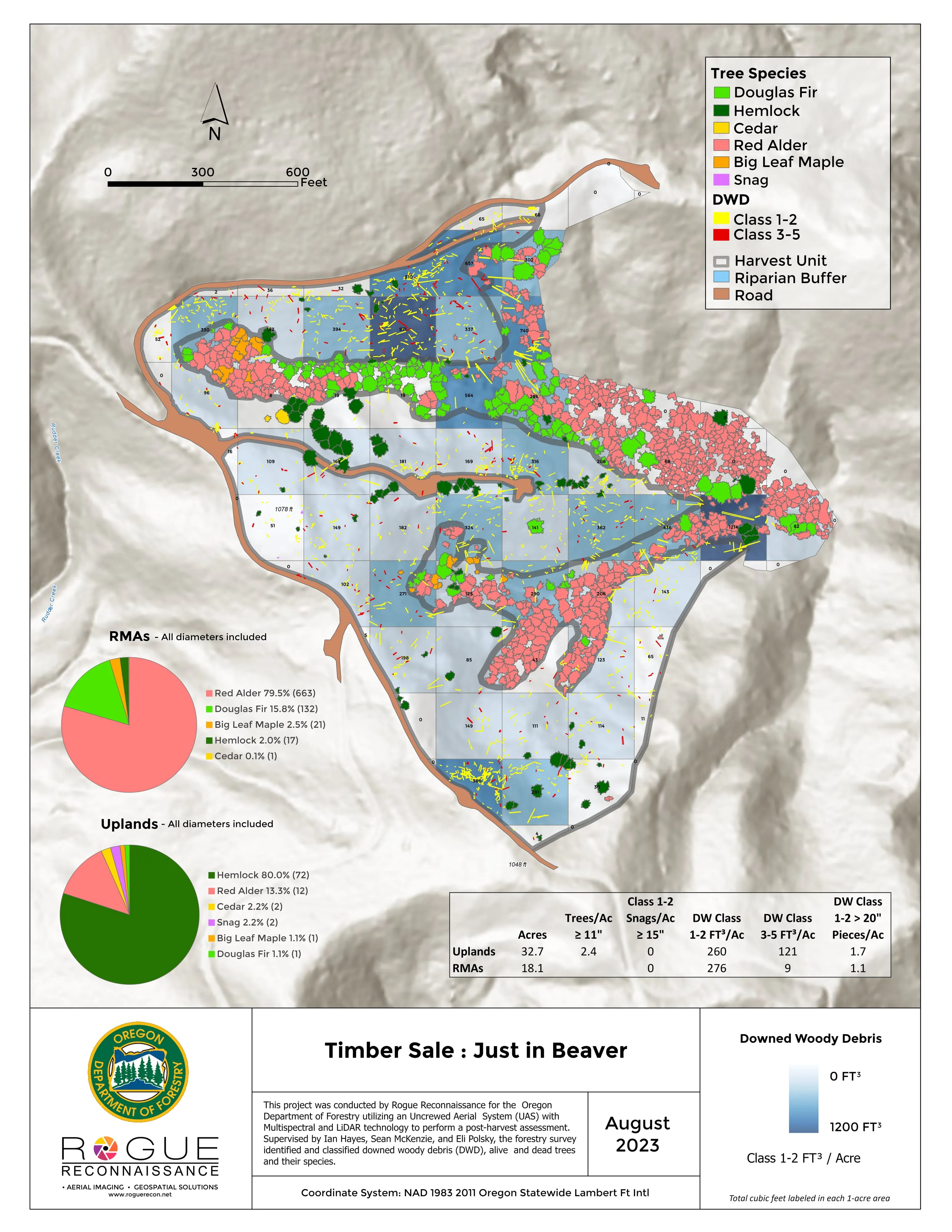
- Post harvest monitoring for ODF
- A planting corridor through Phoenix, tree by tree
Rivers and habitat
- Riparian species and cold seeps on the Scott River
- Ten abandoned mines, bare earth under the chaparral
Wildfire fuels and planning
Night infrared on fires
- Night infrared on ODF incidents since 2019
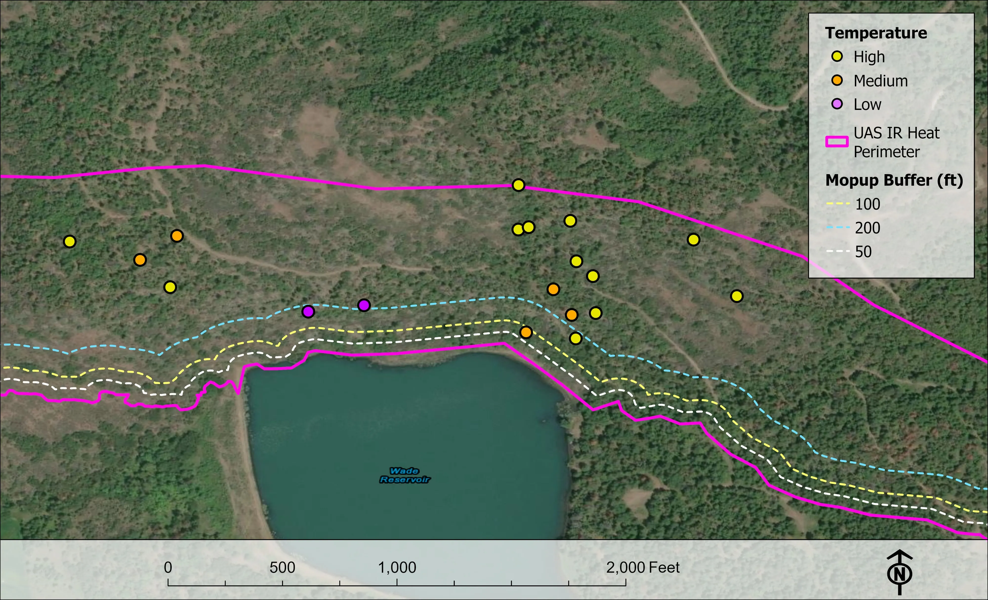
- East Evans Creek, a season inside one fire
- Fielder Mountain, eleven nights as the heat went out
- Woodrat Mountain, from initial attack to the last check
- Interstate 5 at milepost 57, initial attack beside the freeway
- Tyee Ridge Complex
Terrain and site design
Farm planning
Fresno, the valley trip.
An orchard, a parkway reach, a city canopy count or a foothill fuels unit. Tell us the block or the boundary and when the data is needed.
Email info@roguerecon.net or call 808 298 6290.