top of page


1/2
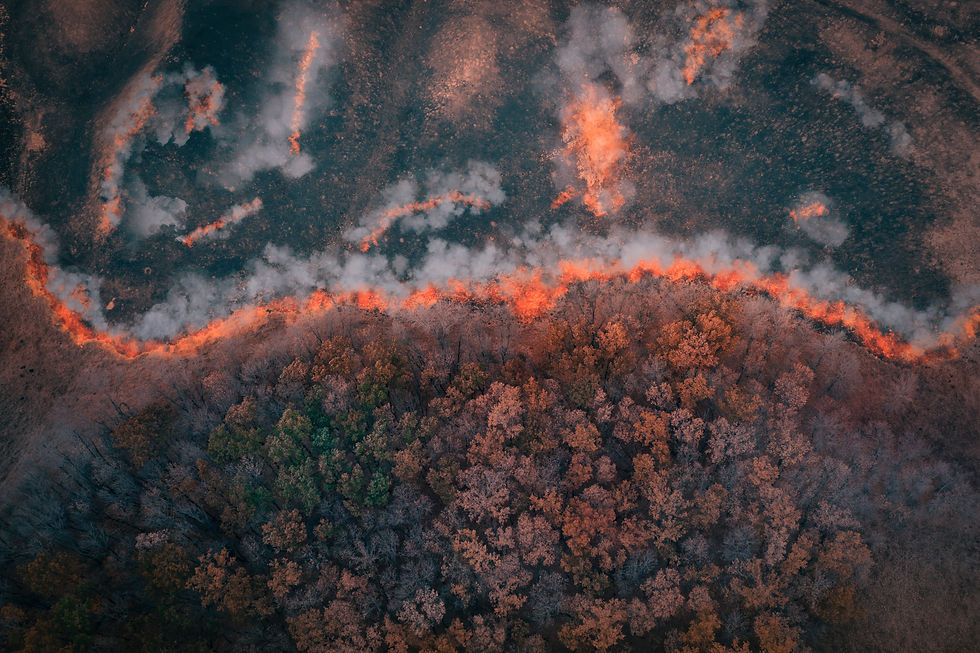
Thermal Mapping
and Scouting.
Plan • Develop • Implement • Maintain
Wildfire Detection and Mapping.
24/7 Support to crews, agencies and incident command
Rogue Reconnaissance was founded by Wildland Firefighters for Wildland Firefighters. With over 20 years of combined experience on the ground working on Hotshot crews, Engines, and Aviation. We have the knowledge base necessary to provide an effective Unmanned Aircraft team to support Wildland Fire operations. Drones provide firefighters with critical information needed to suppress Wildland Fire. Created by Michael Mastrofini, and Elijah Polsky when the two decided to give up Wildland Firefighting with the BLM and US Forest Service in the pursuit of bringing Unmanned Aircraft to the fire line. Spending years on the ground, witnessing countless situations where drones could provide detailed information, and help reduce exposure for ground personnel; the decision was easy. Rogue Reconnaissance aims to provide government agencies with the latest in drone technology. Thermal Scouting for low visibility situations, eyes in difficult terrain to access, Thermal Mapping for detailed information on control lines, Multispectral mapping for prescription fire project work showing mortality rates, and updated high-resolution aerial imagery for forestry projects. All of this is provided by insured remote pilots, red carded for Wildland fire operations.


bottom of page