top of page


Kauai Drone Services
Professional Drone Imaging in Kauai: Accurate Mapping and Superior Aerial Solutions
Certified and Experienced.
Kauai's Drone Mapping and GIS Expertise: Tailored Aerial Solutions in Hawaii
Rogue Reconnaissance introduces top-tier drone imaging and precise geospatial services to Kauai, Hawaii. Equipped with our advanced technologies including LiDAR, multispectral, and RGB sensors, we meticulously map Kauai’s unique blend of natural wonders and cultural landscapes. This vital data collection is instrumental in guiding ecological preservation, supporting agricultural initiatives, and aiding in the thoughtful development of Kauai's diverse environments.
Uncover the Advantages of Cutting-Edge Drone Technology Across Kauai
DRONE LIDAR

Kauai's Aerial Edge: Expert Drone LiDAR Services for Surveying, Forestry, and Environmental Planning
FORESTRY
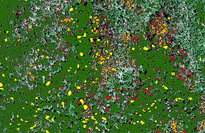
Forestry Insights and Sustainability: Customized Drone Solutions for Kauai's Environmental Stewardship
WILDFIRE MAPPING

Aiding Kauai's Fire Management with Quick Infrared Mapping for Incident Coordination and Field Teams
GEOSPATIAL SOLUTIONS

Kauai's Geospatial Professionals: Precision Mapping and Specialized Application Development
Let's Talk.
We are passionate about geography and the application of geospatial technologies. Our business is built around establishing good relationships with our clients by providing excellent customer service, and that begins with our first conversation with you. Contact us today to find out how our services and expertise can benefit your organization.
Contact.
Serving all of Kauai
bottom of page